Showing posts with label Trip Report. Show all posts

Friday, January 26, 2018

Todd Lake Winter Backpacking

Off the snowshoe route.
 It's strange, but once upon a time I considered winter the off season. No kidding. Back in the day when I was a Spokane local, the thought of backpacking in the snow never even occurred to me. In Arizona, the winter time was desert time. Down there I backpacked year round. Now that I'm in Bend backpacking year round would require a new set of gear and present a new set of challenges, which I would gladly take in lieu of an off season.

 Appropriately prepared with a winter kit, we set off for a local summer hot spot, Todd Lake. This lake, in summer, is always packed. Its parking lot choked with Subarus and Tacomas. A conveyor belt of hikers circling round and round the shoreline. Camping is not allowed in summer. However in winter, the lake is unreachable by automobile due to the closed mountain road. The hike is only a 3-mile jaunt through groomed snowshoe trails. It seemed like a logical first foray into the winter wilds of central Oregon.

Mount Bachelor
Dutchman Flats
The trail-head at Dutchman Flats was near capacity when we arrived at eight on Saturday morning. An unfortunate consequence of being the only snow park in the region with snow. City of Bend, population 90,000. All vying for a parking spot at Dutchman Flats. We set out under a clear blue sky anticipating the sun's appearance over the mountains. The only detraction the constant drone of snow machines. But not a drone as much as a wail. A rising and falling of machine noise. Constant crooning and cranking of so many machines.... In the woods.

In the woods the motors were less noticeable as we left the flats behind. Or maybe we had become used to them by then. The trail lost, we veered off the path navigating by common sense. The lake is that way. We most go that way. The forest became a pitter-patter orchestra by then. The sun melting the snow off the legion of conifers. A conifer concerto if you will.

What is Nate looking at?
 Todd Lake was ice. A cloud hovered just over the surface giving it a dream like appearance. The kind of dream you wake up and try to remember, but only recall bits and pieces. We walked over the ice along the edge toward Broken Top mountain and a suitable camp spot. We nestled in the trees near some streams flowing into the lake from distant mountain tops. The weather was perfect. The scenery amazing. The kind you see on postcards. Some skiers and hikers looped the lake, but otherwise traffic was minimal. No one bothered us save the buzzing of snowmobiles in the distance, and the reek of gasoline. Our constant companion. A constant annoyance. 

The jays were worse. Swooping down from the tree tops to snatch any edible bit left unattended. I've seen people feeding birds from their hands here before. When I've scolded people for doing so I've always been treated like I'm making a big deal out of something small. But it isn't small. Birds stealing your food. Nibbling on your gear. Unafraid of people. It's a big deal because birds, like all animals, naturally have a fear of man. Birds, like other animals, have evolved to feed themselves. Very efficiently I might add or their line would have ended long ago. Feeding birds and other animals is, simply put, unnatural. Some unnatural things we just shouldn't tolerate. Snowmobiles we can live with, because men love machines (it makes them feel manly). But animals need to feed themselves. By feeding them you are harming both the animal and any humans it will encounter in the future

Snowshoe
Frozen Todd Lake with Bachelor in the background.
 We lit a fire on the snow and spent the evening watching it slowly sink through the layers. The jays had long ago fled to deeper reaches of the forest after I convincingly won a snowball war I waged on them (to be fair, their offense wasn't much, but boy could they juke a snowball). We made a bench where we watched the sunset. We were warm and content. We slept well. Probably one of the best night's sleep I've ever had while backpacking.

grey jay
Grey Jay


writer in the wild
Fire making

Dinner
We awoke to the distant buzzing of snowmobiles at first light. We ignored their obnoxious overtures and began the morning routine. The hike back was much faster because we managed to stay on the trail. I think I'll go back. Not to Todd Lake, but further in, where hopefully I can leave the snow machines and spoiled birds behind. That said, I couldn't have asked for a better time.

Sunday, July 23, 2017

Three Sisters Wilderness: Lucky Lake


South Sister
View of Lucky Lake as the trail intersects the lake.
 Lucky Lake is a beautiful mountain lake with great views of South Sister and Broken Top mountains, and it's easy to get to. In fact, the hike is just over a mile, and relatively flat the entire way. I hiked in on a weekday, looking for a quick getaway, and hopefully some fishing. The lake isn't as popular as many Three Sisters Wilderness destinations despite its beauty. Because of this (or maybe the hordes of mosquitoes) I had the lake to myself.

Camp, pre bug net.
 Campsites are concentrated on the south side of the lake. I chose the flattest spot with the best views and pitched my tarp. I was using for the first time a bug net/tarp combination. The net stops at the ground and does not have a floor. I was a bit nervous about its effectiveness pitching it in the midst of clouds of mosquitoes. But it worked great. I slept soundly, and no flying blood-suckers got in.

TFO
Why is my rod on the ground and not in my hand?
 Fishing didn't go so well. Lucky Lake's waters are crystal clear, and I didn't see a single fish of any size either in the water near shore or rising to the surface in deeper parts of the lake. I doubted that any fish were even in the lake despite what I had read online. Regardless, I spent most of the day circling the lake looking for fish and throwing out a fly absent sign of any. It basically became a day-long casting practice session. Lucky Lake isn't a very easy lake to fly fish anyway. Beaches are basically non-existent. In most places, trees grow right to the water's edge. Backcasting is nearly impossible without wading.

 Later that night I heard something big splashing in the water. From the water's edge near my camp I could see a big brown animal frolicking in the water across the lake. I couldn't tell what it was, and I kicked myself for not bringing my binoculars.

A serene morning on the lake.
After a good night's sleep, I awoke to a very quiet, peaceful lake. The water was completely still and the mountains glowed, spotlighted in the rising sun's rays. It's these moments that draw me to the woods. It's these moments that I sit up at night at home in bed thinking about.

Wednesday, February 22, 2017

Smith Rock State Park: Wolf Tree Trail

Smith Rock State Park
Wolf Tree Trail

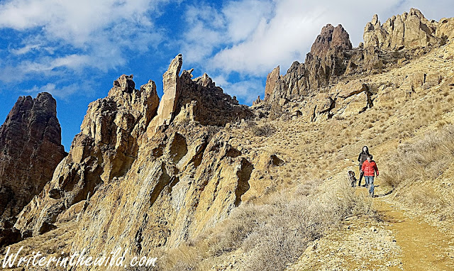
The famous Smith Rock State Park. A local favorite. A climbers dream. A place I'd never been, until now. It was a sunny Saturday morning and we chose a less popular path, Wolf Tree Trail. The trail follows The Crooked River and quickly drops into a delightful juniper/ponderosa pine woodland. The masses don't seem to go this way. Except for the sound of the rushing water it was quiet. Close-up views of the giant rocks that make this place famous parallel the trail (for a close-up of the climbing, bring your binoculars). 

Crooked River
While short and easy, Wolf Tree Trail does offer some options for extending your hike. I recommend the short Burma Road Trail. While steep and exposed, the views at the top are jaw-dropping. From there, connect to the 7.5 mile Summit Loop for a walk around the entire park, or turn around to head back to the trailhead.

Smith Rock State Park
Descent from Burma Road
The Wolf Tree Trail, with The Burma Road side trip, is an easy three mile in-and-out. For me it felt like a teaser. Although satisfied with the views, I found myself wanting more as I climbed back out of The Chute to the parking lot. It's a small park. An ambitious hiker could hit every trail in a weekend trip. I'll put that on my "to-do" list.

Smith Rock State Park
Talus slope

Sunday, January 29, 2017

Oregon Badlands Wilderness: Flatiron Rock

 In the midst of the worst winter central Oregon has seen in 25 years, finding a place to recreate can be a bit of a challenge. Mainly because unplowed roads promise misery for the unprepared driver. I don't want to join the ranks of the many snowbound vehicles I have seen on forest roads in the last couple weeks. So I head to the Badlands. Flatiron Rock trailhead is literally just off the highway. I don't have to navigate any treacherous forest road to get there. I just make a left from U.S. Route 20, and boom, I'm in the parking lot.

Ancient Juniper
A couple route options exist from Flatiron Rock trailhead. We combined Flatiron Trail with Ancient Juniper Trail to form a 7 mile lollipop loop. The scenery in the Badlands doesn't really change, no matter what part of the wilderness you're in. It's relatively flat and covered in old gnarly Junipers (some over 1000 years old), but Ancient Juniper trail had some of the biggest Junipers that I've seen in the wilderness. Some were old and dying and others lush and green. We noticed several were cut with saws, including the Juniper in the photo above. It looked like someone cut a V into it with a chainsaw and then just walked away.

Jonah
 Flatiron Rock is much more discreet than its neighbor Badlands Rock to the east. It doesn't stab upward like Badlands does. Nevertheless, the views from the top are almost just as impressive. From the northwest corner of the rock the cascade range was clearly visible as far north as Hood. I've heard that Flatiron Rock hides a lot of little caves and crevices ripe for exploration, but the amount of snow made finding such places impossible. 

Views of the cascade range.

As usual in the Badlands, we didn't see many people. We also didn't hear any birds... like at all. It's weird because if you read my blog regularly you may recall that I'm constantly remarking about the huge number of birds I see and hear in the Badlands. In fact, since my last visit I've read that the Badlands and surrounding desert host over 100 different species of bird. Today however, I didn't hear a peep. Maybe they were all hunkered down trying to stay warm. 


Hike out


Monday, January 23, 2017

China Hat: Bessie Butte

China Hat is a spot that I've been wanting to explore since moving to Bend last summer. I've heard people talk about it a lot, seemingly because China Hat hosts any activity under the sun (and moon), including hiking, caving, camping, snowmobiling, skiing, shooting, hunting and unfortunately even dumping. The drive is easy from Bend. From my place I can be on China Hat road in 5 minutes. The drive out to Bessie Butte will depend on the road conditions, but is generally around 10 minutes upon reaching China Hat Road (in winter it can be sketchy because the road is not plowed). This ease of access is one reason this area is so popular. The other reason is that it seems far less regulated than other national forest lands in the area.

Three Sisters in the background.
In a land formed by lava and dominated by buttes, Bessie Butte is not one of the tallest. It does however stick out like a sore thumb due to a fire a few years back that really thinned out the plant life immediately surrounding it. Because of this, from the road Bessie Butte appears much larger than the surrounding buttes. We had the trail to ourselves as we made our ascent in freezing temperatures and a bitter wind. I was immediately struck by the absolutely eye-popping views. Even in winter the 1.5 mile hike to the top was easy. On this day we didn't need snowshoes or traction devices, but sunglasses and a beanie were a must. But those views!! It was a perfectly clear sunny day and those Cascades were majestic.

Almost to the top.
At the top the views were even better. Mount Bachelor, the Three Sisters, Jefferson and even Hood were all clearly visible. Literally, on that fine day, we could see as far as the eye could see in any direction. It was totally awesome, and one of the best views I've had in Bend thus far. 

View east from Bessie Butte summit.
The top of Bessie Butte is big. We saw a couple fire rings and I thought it would make an excellent spot to overnight. The views at dawn and dusk would be totally epic. We also saw a rock pile and a makeshift cross fashioned from twigs. The dogs took a keen interest and were trying to overturn rocks to get at whatever was underneath. I guessed the grave contained someone's pet, but who knows. Regardless, I cant think of a better place to be buried. Shoot, I'd like to be buried there.

Grave on Bessie Butte
The hike was short and easy, but the views make it absolutely worth it. Weather permitting, I would like to get out to China Hat again and explore more. There are a handful of caves I want to check out, and of course, never ending buttes. There are some drawbacks about recreating in China Hat. For starters, there are a lot of forest roads, and therefore a lot of offroad style vehicles that make a lot of noise. Also, apparently China Hat is the premier local spot for shooting. We heard plenty of gunfire and saw people parked off the side of the road just shooting into the forest. Hiking in an area that people use to shoot can be a little unnerving, especially when you see people not being responsible about it. Also, in my experience, areas that see high amounts of recreational shooting also see high amounts of trash from shooting, like spent casings, shot-up bottles and cans, and remnants of clay pigeons. Didn't see any of that first hand in China Hat, and hopefully I never do.

Bessie Butte descent.

Clarifying place names - "China Hat" is an area of the Deschutes National Forest just south of Bend, Oregon. The specifics of location are difficult to define because China Hat is not the official name. Rather, it's the name given to the area by locals. If a local says, "I'm going hiking in China Hat," they are referring to a large geographical area with undefined borders. China Hat is named after the best road that runs roughly north/south through the area, China Hat Road, which is in turn named after China Hat Butte. China Hat Road and China Hat Butte are defined places found on a map or Google search. China Hat is not. Unofficially, China Hat is bordered by Bend to the north, Highway 97 on the west, and Newberry National Volcanic Monument south and west. The eastern boundary is even more challenging to define, but I'll say that if you reach Horse Ridge Natural Area, you've gone too far. If you feel this description is incomplete or inaccurate, please feel free to send me an email with your thoughts. writerinthewild@gmail.com

Monday, January 16, 2017

Oregon Badlands Wilderness: Badlands Rock

Old Juniper on the Badlands Rock Trail

The Oregon Badlands Wilderness is quickly becoming my "go to" spot for hiking and exploration. Access is less than 30 minutes from town, yet the crowds are nonexistent. My original plan for this day was to check out Tumalo Falls, but when I arrived vehicles lined the road leading to the trailhead and people poured from them with snowshoes and nordic skis. It was so crowded that I immediately turned around and headed for the Badlands. Solitude is a big part of why I like the outdoors, and nothing outside turns me off faster than crowds.

An hour later I'm in the Badlands. The hike was usual Badlands fare; flat terrain, Junipers aplenty and all the solitude a man could want. Unlike my first foray into this wilderness, Badlands Rock Trail occasionally opens up to views of the surrounding hills. The Junipers here are more sparse. The country just feels more open. I'm struck by the sheer number of birds I see and hear in this wilderness. I'm accompanied by birdsong everywhere I go. 

From atop Badlands Rock
I was surprised by the size of Badlands Rock when it finally came into view near the 2.5 mile mark. I wasn't expecting it to be so big, and was overcome with the urge to climb it. The scramble was a bit tricky due to ice and snow, but the view from the top has to be the best in the entire Oregon Badlands. 

Unnamed hiker on top of Badlands Rock

More views.
From Badlands Rock, one has two options for longer loop hikes. I went west on Castle Trail which had not been used since the most recent snowfall. Breaking trail was slow going. By the time I reached The Castle (halfway between Badlands Rock and The Flatiron) I felt like I was on a race against time to beat the setting sun, so I retraced my steps back to the trailhead and made it just in time. This area definitely deserves so more exploration. I like the idea of backpacking here, but being a relatively new wilderness, and playing second fiddle to the cascades, I have not seen nor heard of any backcountry campsites... Until next time.

Breaking trail

Monday, November 28, 2016

#OptOutside Cougar Hot Springs Debacle


Cougar Reservoir

Another holiday season upon us, another chance to escape the madness by opting outside on Black Friday... Or so I thought. This year our family decided to laze the day away in Cougar Hot Springs. A popular destination nestled high in the cascades off the bank of Cougar Reservoir. The views during the two hour drive up from Bend were amazing, and by the time we pulled off the highway we were all antsy to be out of the car and exploring. But it wasn't meant to be. At the hot springs at least.


Cougar Hot Springs parking lot
 The parking lot was overflowing with vehicles. They were packed so tight that several cars were in the road. The people that arrived early, and were parked in actual parking spots, were completely blocked in by the latecomers who just parked behind them. It was a total disaster. I found a spot near the parking lot on the shoulder of the road, but a forest service employee threatened me with a ticket if I stayed there. I drove up the road looking for alternative parking but found nothing. I circled back and waited patiently for someone to leave. Impatiently, my kids begged me to double-park next to someone, but I refused. After a half hour of waiting, there were now three vehicles just sitting on the side of the road waiting for people to leave the parking lot. Meanwhile the forest service employee perused the parking lot writing tickets. Finally, a man came sauntering up the trail toward the parking lot. He saw that his car was blocked in and threw a fit. He began yelling at the forest service employee. At this point we were all restless and irritable in the car, so I decided to abandon the hot springs despite the fact that we drove two hours to get there. It was totally demoralizing, especially for my kids.

Delta Camp nature trail
Determined to make the best of such a disappointing turn of events, we pulled into a closed campground we passed just to get out of the car and explore. Delta Campground was an awesome campsite surrounded by old growth rainforest and towering western red cedars. Here is the kind of forest that just looks ancient. The trees like sentinels. Something out of Lord of the Rings. We explored the campsite and short nature trail nearby. The dog went nuts. The kids ran and laughed and soaked their clothes in the dense foliage. It was fun, and the frustration of earlier in the day was forgotten.


Wednesday, November 9, 2016

Oregon Badlands Wilderness: Larry Chitwood Trail

Do you know what I love about Bend the most? I can drive 20 minutes out of town in nearly any direction, and be in the woods. Today I forsook the mighty Cascades and went east. East toward the desert, into the Badlands. The Oregon Badlands got mixed reviews from my coworkers at REI. Descriptions ranged from "beautiful" to "boring".  Being a self-proclaimed "desert rat" I had to check it out. 

Historical artifacts?
The Larry Chitwood Trail offers the closest access to any trail in the Badlands Wilderness, and my Silverado was the only vehicle at the trailhead. After hitting the trail, I was immediately impressed. The old Juniper scrubland baked in a golden glow from the rising sun really reminded me of the Mazaztal Wilderness in Arizona, and it was absolutely awesome. The only problem? Piles of rusted cans and broken glass. Apparently, Bureau of Land Management considers the trash some type of historical artifact. Some of it may even be remnants of The Oregon Trail (as in, "Go west young man"). 

High desert Juniper scrub lands.
Looking at the map, the Larry Chitwood Trail is kind of a lollypop figure-eight loop, and that's exactly how I intended to hike it. I started with the west loop. I was surprised almost immediately by the amount of deer tracks I saw. In fact, I spent about 5 hours jacking around in that little stretch of wilderness, and I saw more deer sign than I've ever seen in one place in my life. The ground is really soft sand, so literally everything leaves a print. Deer, coyote, cat, I saw it all. I realized pretty quickly that the Oregon Badlands Wilderness is crawling with critters. 

The west loop was kind of a bust. Most of its length it skirts private property, and at times the trail just inched a little too close for my taste. In fact, at one point a mangy old farm dog howled at me as I strolled by. It wasn't the dog that worried me. It was its owner. Luckily I was out of sight before anyone popped out of the doublewide gung-ho with a double-barrel.


The east loop was more my style. Deeper into the wilderness. Away from roads and farms and loud-ass power tools. All I heard was birds. A concerto of birds in fact. Celebrating an unseasonably warm November no doubt. The deer tracks became more frequent. I started to see scat. I even saw bear scat, which if the Oregon Department of Fish and Wildlife is to be believed, bears are ... "absent from arid regions of central and southeastern Oregon." I've seen a lot of bear poop in my day, and I'm pretty sure this is it (see below).

Bear poo?
Overall it was a fun trip. I didn't see a single person other than myself. Just a lot of birds and animal tracks. If you're looking for solitude, the Oregon Badlands Wilderness is the ticket. If you're looking for views, go elsewhere (west young man). I will return for sure, but probably in the winter months when it's a bit colder. Maybe a backpacking trip is in the cards for me as well. The Badlands has no water that I know of, which surely assists in keeping the masses away, but coming from Phoenix that's something I'm used to.

A final note. There are dozens of unmarked trails in this area that aren't on the BLM map. Route finding can be challenging, especially if you take a wrong turn. It's best if you study the area from above beforehand to get an idea of the layout (google earth), and don't forget your map and compass!

Wednesday, August 10, 2016

Three Sisters Wilderness: Doris Lake

Fishing didn't go so well.
I finally got out for my first Oregon backpacking adventure. Since Bend is still so new to me, I didn't quite know where to go. In the Three Sisters Wilderness, everyone says Green Lakes is the place to be. Since I did Green Lakes as a dayhike, I wasn't really interested in going back. Mainly I wanted to avoid the crowds that I knew would be clogging up the trails. After studying a map, I settled on Doris Lake instead. It's an easy hike, and the fishing was supposed to be decent. 

The hike in was as easy as advertised, and mostly in the shade of the big evergreens. After recreating  in the desert for so long I almost felt claustrophobic among so many trees. Line of sight is a fraction of what I usually had in the desert, We passed a few groups hiking out, either complaining about mosquitoes or wearing headnets. I knew we were in for a treat.


After making camp near the lake I tried my luck fishing. I love fishing, but I've decided that I'm not very good at it. I threw out an orange Panther Martin (recommended to me by the fishing guy in Sportsman's Warehouse) and spent the next couple of hours reeling in... an orange Panther Martin. The beach nearest my tent was infested by big red ants which literally bit the hell out of my feet every chance they got. Literally, every time I stepped down, all ants within a foot radius would immediately charge my foot like a platoon of gung-ho marines. If I moved my foot they would chase it. Those little bastards were aggressive as hell. But the scenery was nice and the water was perfect, so I gave up fishing and went for a swim instead. The ants didn't follow me in.


Video: Starting a fire with Old Man's Beard

Late afternoon the mosquitos were swarming. I was covered head-to-toe in protection, but they were chewing up my dog Rocco. I started a fire early, deciding to turn-in when the sun set, I sat by the fire sipping some Irish whiskey and watching. The trees were covered in Old Man's Beard and the setting sun turned everything green. As far as I knew, Rocco and I had the lake to ourselves. I didn't see or hear another soul.

Doris Lake camp

Monday, August 1, 2016

Three Sisters Wilderness: Green Lakes

Fall Creek
 Oregon. That is where I now reside. I've traded in saguaros and century plants for pine and spruce and fur. I'll miss the desert, but Oregon is a homecoming for me of sorts. If you've followed my blog long enough, you know that Spokane, Washington was where I began this journey. Now, I'm in Bend. The final destination... Hopefully. 

The boundary for Three Sisters Wilderness is literally a 20 minute drive from Bend, and the road is paved. With such easy access you can guess that Three Sisters is one busy wilderness. Green Lakes is supposed to be a primo locale in the wilderness, and late June is supposed to be the best time to go... Before the snow melts and the hiking hordes arrive. We were on the trail by 9 am, and the humongous parking lot was mostly empty. I had been warned about the crowds, but it didn't look too bad. 

Three Sisters Wilderness


Green Lakes is roughly a ten mile round trip hike over nicely maintained trail. Early in the year however, the trail is easy to lose in the snow. It's been awhile since I've hiked over hard packed snow, and almost immediately I wished I would have brought some microspikes. As a result, I was slipping and sliding all over the place, but at least I wasn't postholing. Shade from the trees, and the constant sound of running water from Fall Creek were a welcome change from the desert. Another key item I didn't bring was a pair of sunglasses. I remember walking out the door thinking, "I don't need my sunglasses, I'm not in the desert anymore," Boy was that a mistake. Walking over snowfields on the approach, my eyes ached from the glare of the sun off the snow. My eyes hurt so bad that I was worried about going snowblind. To eliminate the glare I had to walk with my hands cupped around my eyes, which drastically reduced my peripheral vision and caused me to constantly lose my footing. I felt like a complete rookie up there.

Three Sisters Wilderness
South Sister
 We found the lakes still frozen over, but the mountain view was awesome. Craggy "Broken Top" and the solitary "South Sister" overlook Green Lake from the right and left. I thought that Green Lake would be an excellent basecamp if I ever felt the need to climb either of them. I had brought fishing gear, but the lake was still frozen over. 

Three Sisters Wilderness
Broken Top
 We didn't see barely anyone on the hike in, but the hike back we passed probably 50 people. One group of backpackers had lost the trail under the snow, and didn't seem to know where they were. Another group of mountaineers were heading for Green Lake to make a basecamp for a summit bid on South Sister the next morning. Most were day hikers like us.

Return trip along Fall Creek
 The giant parking lot was completely full when we returned to the trailhead. I was beginning to realize just how popular this area was. Since the trip I've learned that Three Sisters Wilderness is the most visited wilderness in Oregon, and Green Lakes is its most popular trail. I think I'll skip that trail for the rest of the summer and find something a little more out of the way.

Creek crossing with the puppies.

Wednesday, April 20, 2016

Grand Canyon: Corridor Trails - Phantom Ranch to Indian Gardens and Out.

Leaving Bright Angel Camp
Another world exists at the bottom of the Grand Canyon. I've never felt so wild as I did in that place, despite the people. It's the place that does it too. The canyon itself. Its unfathomable enormity. Its abysmal depths. You recognize it from the top, but you don't feel it until you reach the bottom, and look back in wonderment at where you came from. The only way out is up. Way up. Nearly 5000 feet through some of the most rugged landscape on earth. Leaving Bright Angel camp on day four was bittersweet. The prospect of exploring new country is thrilling, but the planned climb to Indian Gardens meant that our trip was nearing an end.

Following the Colorado River
The Colorado River stokes my imagination more than an other river I've seen. Paralleling its banks, I imagined what it would have been like for the early river runners. Imagine running the Colorado through the canyon without any notion at all of what would be around the next bend. Talk about a heart pounder! Leaving the river we came to a seesaw of steep switchbacks as we climbed higher and higher. We passed a mule train of tourists bound for Phantom. We passed a group of foreigners attempting a rim-to-river-to-rim in one day. It's a feat that the park service highly discourages. They weren't wearing backpacks, and each carried a plastic water bottle in their hand. We warned them about the heat and lack of water. To us backpackers they seemed ill-prepared for such an undertaking. Of course, they didn't speak a lick of english and just looked at us with smiles on their faces as we warned them to turn back. "Ok" they said, nodding up and down and grinning foolishly. They kept going.

Sawteeth

Flattening out on the approach to Indian Gardens
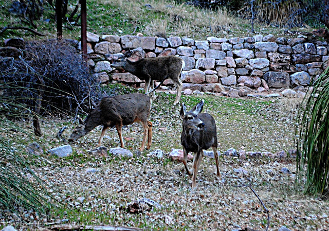
The terrain flattened as we approached Indian Gardens. Cottonwood trees and shade appeared. So did the mule deer. We saw them everywhere. On the trail. Near the trail. Lots of does, but not a single buck. As a bow hunter, I was struck by the differences of this game animal's behavior within the boundaries of the park, and deer I encounter elsewhere. We passed within a couple feet from some feeding trailside, and they never spooked.

Indian Gardens
Mule deer at Indian Gardens
Indian Gardens turned out to be my favorite camp site. It certainly had the best views. We had the place to ourselves (more or less), and were treated to an amazing sunset. From Indian Gardens at night, you can see lights from the buildings on the south rim. The deer were everywhere at camp too. They fed all around us without a care in the world.

First snow
Next morning we got an early start and climbed out of the canyon. The snow and ice were still present near the top, so we again had to don microspikes. As we neared the rim the amount of day hikers increased dramatically. We saw tourists in dress shoes hiking across ice on narrow trails that, if you slipped, could result in falls of hundreds of feet. Their nonchalant attitudes made it appear as if they had no idea they were courting death. 

The rim in sight,

Almost out,
I'm afraid now that this will be my last Grand Canyon adventure ever. I have a four day backpack in Paria Canyon on the horizon, and after that I will be relocating to Bend, Oregon. I'm excited to have a new state to explore, but I'll sure miss the desert.