Wednesday, November 27, 2013

Gear Review: Osprey Xenith 75 Liter Backpack

Osprey Xenith
Osprey Xenith

"Opening the Osprey Xenith backpack after it arrived to my door, I was reminded of the Two Towers. This is a big backpack. At 75 liters, mine is the smallest of the series (they also come in 88 and 105), but certainly much larger than the 50-liter pack I normally carry. I was slightly intimidated. Being a lightweight backpacker I wondered how I was going to fill it up. I accomplished this feat by packing books on solo trips, and carrying all the shared gear when I hiked with a partner. Even then, I only managed a pack weight of 35 pounds, and it was the easiest 35 pounds I ever carried."

Read the rest of my review at: 

Monday, November 25, 2013

Hardscrabble Mesa

Jimbo
Arizona is a state with some very interesting place names. I've seen Bloody Basin, Horsethief Basin, Hell's Hole and Hell's Canyon. Seen towns called Happy Jack and Tombstone. It's all reminiscent of the old west heritage of the state, but I've also noticed that these places get those funny names for good reason. Hardscrabble Mesa is one of those places. 

Breakfast done right.
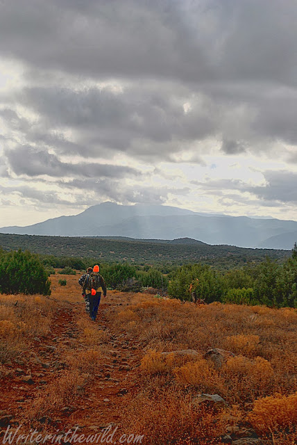
This trip was mainly for my friends Jim and Adam who wanted to scout a possible location for an Elk hunt. It borders the Mazatzal Wilderness, and is some really rough high-desert terrain dotted with juniper. What makes the terrain so rough is that the ground is covered in rocks and boulders. It caused us a bit of difficulty finding a good place to camp, as Adam and I were tenting it and needed a spot of land relatively flat and rock-free. After we spotted a few Elk hiding among some Junipers, we found a suitable spot and made camp. We spent the evening drinking beers by the fire (except Adam who doesn't drink), and chatting about the next day's hike. 

I had to break the news to the guys that I would be skipping the hunt next week. Since I started my new job at Amazon I've had to cancel several backpacking trips (including a 4 day Superstition trip) due to the really crappy schedule I have. It really sucks, and goes to show why I got back into college. I hate living for work. I hate not being able to do what I really want to do. It makes me feel like a slave.

Adam
 The next morning we hiked into the Mazatzal Wilderness. It was slow going because of the terrain. We talked about how difficult it must have been for wagons to cover this ground back in the day. This must be why this area was called "Hardscrabble". It was easy to imagine a lot of broken wheels, twisted ankles, and sleepless nights. We did see plenty of Elk sign throughout, and had a thoroughly enjoyable day despite all the beers we drank the night before. This area is just really pretty, with gorgeous views of the Mazatzal range throughout. I still haven't visited the Mazatzal mountains, but am eagerly awaiting the day that I do. From a distance they look so mysterious and foreboding and remote. I can definitely see myself backpacking there someday.

As I mentioned previously, I am missing the upcoming hunt. I have absolutely zero future plans for outdoor adventuring at the moment, which is quite depressing. On the bright side, this job is seasonal, and shouldn't last past January. I am going to need to do something epic to make up for the lost time.

Hardscrabble Mesa with the Mazatzal's in the distance.


Tuesday, November 19, 2013

Victory Dance

Just wanted to share an awesome contest that Mountain Gear is putting on. The grand prize is sweet. This is not a giveaway, it's a contest, so everyone has a good shot to win it. Get creative and have fun. Check it out.

From Mountain Gear:

We've just launched our #PersonalSummit #VictoryDance Video Contest. All you have to do is snap a quick video of you doing the dance you'd do when you achieve an athletic goal. Have fun with this! You just might win a full Arc'teryx Beta AR series - jacket, pants, & gloves. Enter via your mobile device or computer: http://bit.ly/VictoryDanceVideoMobile

Monday, November 18, 2013

Gear Review: Mosquitno Insect Repellent Products

Rocking a Mosquitno wrist band.

Mosquitno (emphasis on the "no") is a family run company out of Kansas City that makes natural insect repellent products using citronella oil. Currently their 2 main products are citronella infused wrist bands and stickers that are easy to apply, reusable, and come in a variety of colors and designs. 

Lets be real here. When we talk about "insect repellent" what we usually mean is "mosquito repellent". Mosquitoes can be a total nuisance, and when they are swarming can turn any outdoor adventure into an exercise in misery. Mosquitoes can also carry a variety of diseases like West Nile Virus, Dengue Fever, and Malaria to name a few, so it's important that when we venture into areas with a mosquito presence we protect ourselves. That is where Mosquitno insect repellent products come in.

Unlike DEET (the chemical most commonly used in insect repellent), Mosquitno products use citronella oil, a natural insect repellent obtained from various species of lemongrass. The EPA lists citronella oil as low to non-toxic and says that citronella "will not pose unreasonable risks or adverse affects to humans or the environment." That safety factor is really what separates citronella oil from DEET. I know a lot of hikers (including myself) are hesitant about using DEET because of some of the risk factors involved from overuse or improper application, such as disorientation, dizziness, and even death in extreme cases.

On the other hand citronella oil is both a safe and effective repellent. It works by masking the scents your body gives off that would otherwise attract bugs like mosquitoes. In spray form, citronella (and other natural repellents) need to be regularly applied to remain effective, but with the Mosquitno brand products one band or sticker can last for hours.

Mosquitno products
Testing the Mosquitno products was somewhat of a challenge since the presence of mosquitoes was required. My first testing was done at home where it seemed like every time I went outside around dusk my feet and ankles were mauled by mosquitoes. I used the Mosquitno stickers (called Spotz), and just stuck one directly to the top of my foot. The Spotz are basically small round citronella infused stickers that will stick to pretty much anything. They are also easy to remove and last up to 72 hours. Since Spotz come in a package of 6 you are looking at 432 hours of bug protection in one package. Pretty cool! The best part is that when you go inside or the temps dip and the bugs disappear, you can reseal the sticker in the package to maintain effectiveness.

The silicone wrist bands (called Bandz) work the same way. They come in adult and child sizes, and slip on just like a bracelet. The Bandz last up to 150 hours and can also be resealed. What I love about the Bandz is the convenience. Keep it in your pocket until the bugs show up. When the bugs are gone, just take the Bandz off, reseal it, and shove it back into your pocket. No fuss, no muss. No gunk on your skin. No funky chemical smell. No worrying about applying another coat or ruining your fabrics.

The only issue one might have while wearing the Bandz is that the citronella smell is extremely powerful. So powerful in fact that your hiking mates and camp buddies will smell it when they get near you. The lemon-like smell is quite pleasant to me (in fact citronella oil is commonly used in aromatherapy), but some may find it a bit much (like my buddy James last weekend for example).

Overall, I really think the folks at Mosquitno are on to something. I like the idea of NOT using sprays or creams, and am always on the lookout for safe yet effective alternatives to DEET. In my experience citronella oil repellents are most effective when the bugs are light to moderate, and Mosquitno Bandz and Spotz are ideal for those types of conditions.

Mosquitno Spotz on my foot.

Disclosure of Material Connection: I received Mosquitno Bandz and Spotz for free from Mosquitno as coordinated by Deep Creek Public Relations in consideration for review publication

Monday, November 11, 2013

Tom's Thumb

Jordy is staying hydrated.
 Ever since I moved to Phoenix I've wanted to hike in the beautiful McDowell Mountains. which are visible to the east just about anywhere in the Paradise Valley/Scottsdale area. The McDowell Mountains are a nice change of pace from the Phoenix Mountains, as they boast humongous granite boulders and lots of interesting rock formations. The desert here is also higher than the Phoenix Mountains, and definitely has more of a "high desert" feel minus the creosote scrub-lands so common in low desert locales.

Climbing in the McDowell Mountains
Tom's Thumb Trail is a popular one that I've heard many people talk about, and for good reason. The area is absolutely beautiful. The trail rises gradually at first as it winds up the mountains, and eventually opens up to some expansive views after some steep sections. I'm not sure how long this trail is because every website I visited to find that information gave me a different answer, but I can say that it certainly feels short, but steep. From the high points on this trail you can see the rugged Superstitions, the mysterious Mazatzal's and the fabled Four Peaks. 

Tom's Thumb
Tom's Thumb
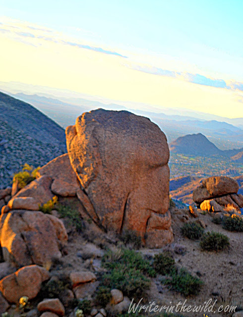
The mountains are extremely rocky, much more so than the Granite Mountain Wilderness that I visited a couple months back. The boulders are spectacularly gigantic. When I made it to the top and saw Tom's Thumb close up, I could not believe how huge it was! It looks like some kind of giant stone church standing sentinel-like on the mountaintop overlooking the vast desert congregation. It was pretty awesome!

See the arch?

Indeed, large rock formations like Tom's Thumb are frequent throughout Tom's Thumb Trail. Some of the boulders are as large as buildings. Some have faces in them. Some even harbor caves and crevices and good places to hide from the elements if one ever got stranded. It's pretty awe inspiring being so near such giant pieces or stone.

Face in the rock. Do you see? 
Overall it was an awesome hike. Even my nephew Jordy had a great time taking in the scenery and watching me bound up the trail ahead of him. Those Kelty Child Carriers are pretty sweet packs for getting the little-one's outside. For my money the McDowell Mountains (this section anyway) is by far the most beautiful hiking destination in or immediately around the Phoenix area. Other than Spur Cross in Cave Creek, nothing even comes close, and I can't wait to get out there again.


Monday, November 4, 2013

Embrace the Pain

Last week I started a seasonal position at the Amazon.com fulfillment center. Since my writing hasn't made me independently wealthy yet, and the guiding is so sloooow, I needed some supplemental income with the holidays approaching. The Amazon warehouse is like that warehouse in Indiana Jones and The Kingdom of the Crystal Skull; gigantic and seemingly never ending. When I was hired in stow they told me I could potentially walk up to 20 miles a day. I was actually excited about the prospect. Ever since I was a kid I have loved to walk. All growing up, and even into adulthood, I had a reputation among my friends for just taking off on foot. If I was without wheels and there was someplace I had to be, I just "beat feet" or took the old "heel-toe-express". 

I don't know, maybe that's why I became a hiker, and because I'm a hiker, I actually thought that walking 20 miles a day wouldn't be so bad. Boy was I wrong! I couldn't believe how bad my feet hurt by the end of that first day. I thought my Merrell Moabs and merino wool socks would keep my feet felling tip-top, but instead they throb in pain. Well, since there isn't really anything I can do about I just grit my teeth and keep thinking, embrace the pain!

"Embrace the pain" is something my cousin Luke always used to say when he was in pain. The theory is that because stopping the pain isn't an option, you just embrace it. Become one with it. 

Hiking can be a mental game a lot of the time, especially on long days. I've said that axiom aloud to myself numerous times on the trail when my feet were screaming, or my shoe was rubbing on a giant blister on my heel, or my back hurt. It's about changing your thinking so you don't quit. So you don't give-up. There isn't really much worth doing that it isn't going to cause some amount of hardship, weather it's hiking or going to the gym, or even writing. If we quit every time something is hard, or every time we felt pain, then we wouldn't get anywhere.

I also keep in mind that pain is only temporary, and experiencing it is a requirement to accomplish my goals, just like the old saying "no pain, no gain". It helps to keep the endgame in sight, whether it's the mountaintop or the shift bell. 

So, next time your'e feeling like giving up because the misery is too much, embrace the pain, and you'll see it through.

Thursday, October 24, 2013

Shaw Butte

North Mountain Park
 Endeavoring to explore more of the local hiking trails in Phoenix, I visited North Mountain Park yesterday and hiked the 5 mile trail #306 around Shaw Butte. This area features typical lower Sonoran desert ecology with plenty of creosote, cacti, and palo verde. Like the rest of the Phoenix Mountains, the terrain is extremely rocky and rugged, and right off the bat I spotted a large outcrop of greenstone which contrasted nicely with the predominantly brown landscape. The geologic processes that formed the Phoenix Mountains must have been pretty spectacular because the rock is so diverse in size, shape, and color.  I find the rocks to be one of the more interesting aspects of these mountains. 

Outcrop of greenstone
 Another point of interest on this trail is the remains of a 1960's era restaurant called Cloud 9. You can find the ruins on the south side of Shaw Butte near the top. Built right into the side of the mountain, the restaurant would have provided its patrons with a spectacular view of downtown Phoenix and the central valley before it burned to the ground in 1964. The restaurant was also home to its eccentric owner and builder Richard Barker and featured a swimming pool, a Cold-War era bomb shelter, and apparently held illegal poker games for its high profile guests. You can read more about Cloud 9 here.

Ruins of Cloud 9 overlooking Phoenix

Just passed the ruins of Cloud 9 is a series of switchbacks that lead to the top of Shaw Butte. I decided to skip the summit because it's covered in antennas and radio towers, and I wasn't really feeling an overriding urge to see them up close. Plus, even though the temps were only in the 90's, the sun was mercilessly beating on me, and it was affecting me more than usual, probably because I haven't hiked in about a week.

Cactus Wren (Arizona state bird)
 Overall it was an okay hike. I didn't see a lot of wildlife, and it was so close to the city that I couldn't escape the noise of traffic anywhere on the trail, which I found distracting. To me, North Mountain Park is the least pretty area in the Phoenix Mountains that I've visited. Not that It isn't worth a visit, or that I'm not grateful that it's preserved and available to hike. I just think that it doesn't compare with the main body of The Phoenix Mountain Preserve near Piestewa Peak, which is bigger, and offers more solitude, higher peaks, more dramatic rock formations and desert plants, and has more animal life. Well, thanks for reading. Until next time.

What passes for a high point in the desert

Wednesday, October 16, 2013

Hail the Hypocrites!

When I signed up to write about Human Rights for Blog Action Day 2013, I had no idea what I was going to write. I of course waited until the day it was due to even begin, but I came up with something that I hope will provoke thought and discussion among those of you who read it. Please feel free to comment below if you have anything at all to say, even if you think I'm full of crap. I can take it. - Mike

I don't think any discussion of Human Rights can begin without an understanding of what these so called rights even are. All I knew was that Human Rights are simply rights that all human's should have, but what these rights were, I did not know. A Google search directed me to The Universal Declaration of Human Rights adopted by the United Nations in 1948. This declaration, written on the heels of the most savage war in human history, presents a specific set of rights inherent to all humans, much like our own Bill of Rights. Reading the 30 articles, I was struck by one overpowering thought that drowned all others. 

In the United States, our political leaders and public figures, as far back as I can remember, have stood high on the mountaintop of morality and extolled the virtues of human rights with the fervor of a southern baptist preacher on Sunday morning. Everyone deserves freedom we are told. All people deserve basic human rights they say. 

But these same people who speak so passionately, and so assuredly... These same people who build schools in Africa, and send food to North Korea... These same people who chastise the "unenlightened" nations for their treatment of women, and suppression of free speech and religion... These same people to whom human rights are so important they wage war so that others may have them... These same people piss on our own rights here at home.

Make no mistake, this isn't a political rant. I'm no republican or democrat. I haven't cast my lot with any groupthink ideology or philosophy. I've cast my lot with humanity... With my country.

Our leaders point their fingers at the world and lecture from plastic pulpits about the ideals of freedom and democracy, while at home they tighten the screws of the control machine. Our celebrities and affluent philanthropic do-gooders shovel billions into non-profits that work to ensure and protect the human rights of others around the world, while ignoring the mounting human rights violations that are happening here at home.

All hail the hypocrites I say! For even as laws and presidential orders systematically strip our rights away, we apathetic masses shuffle happily about our daily routines ignorant and oblivious... The greatest swerve in the history of mankind, sure to be admired by the masters in deception of ages past, and emulated by future tyrants the world over. Obediently we sit, content with our iPhone's and flatscreen TV's. Plugged in, but tuned out...

In a time of unprecedented government control, I'm curious if I even have the right to write this blog? Will I be considered an enemy of the state for what I've said, or be placed on some kind of government watch list? Will my emails be read, and my cell phone taped? Will I be arrested, and if so, will I be allowed an attorney, and the right to a speedy trial? Will I even be allowed a trial at all? If I'm considered a threat, will I be assassinated? Will our Bill of Rights remain law, or merely a novel museum attraction to be undermined and ignored?

Perhaps you read that last paragraph and are thinking that I've finally went off the deep-end in this blog post, but sadly, in today's United States of America all of those scenarios could actually legally happen, and as we silently drift through the information age oppressed, uninformed and uncaring, I can't help but wonder what the future holds for us if we don't act. What rights will our children have?


My call to action for Blog Action Day 2013 is to ask yourself a simple question... 

Am I really free? 

If the answer is no, then do something about it.

Educate. Vote. Protest. Petition the president and congress. Talk with your friends and coworkers. 

Perhaps more importantly, be vigilant about the words our leaders speak, and the dissemination of information by media. Doublespeak and propaganda flow freely from these pawns of disinformation, but like the truth itself, may be camouflaged and difficult to spot. Read multiple sources. Form your own opinions. Take everything you read with a grain of salt.

I'll leave you now with an excerpt from a speech by Chief Joseph of the Nez Perce circa 1879


"...I have heard talk and talk but nothing is done. Good words do not last long unless they amount to something. Words do not pay for my dead people. They do not pay for my country now overrun by white men. They do not protect my father's grave. They do not pay for my horses and cattle. Good words do not give me back my children. Good words will not make good the promise of your war chief, General Miles. Good words will not give my people a home where they can live in peace and take care of themselves. I am tired of talk that comes to nothing. It makes my heart sick when I remember all the good words and all the broken promises. There has been too much talking by men who had no right to talk. Too many misinterpretations have been made; too many misunderstandings have come up between the white men and the Indians. If the white man wants to live in peace with the Indian he can live in peace. There need be no trouble. Treat all men alike. Give them the same laws. Give them all an even chance to live and grow. All men were made by the same Great Spirit Chief. They are all brothers. The earth is the mother of all people, and all people should have equal rights upon it. You might as well expect all rivers to run backward as that any man who was born a free man should be contented penned up and denied liberty to go where he pleases. If you tie a horse to a stake, do you expect he will grow fat? If you pen an Indian up on a small spot of earth and compel him to stay there, he will not be contented nor will he grow and prosper. I have asked some of the Great White Chiefs where they get their authority to say to the Indian that he shall stay in one place, while he sees white men going where they please. They cannot tell me."


References:


Monday, October 14, 2013

Gear Review: StrongVolt Solar 7 - Portable Solar Charger

SrongVolt Solar 7

The StrongVolt Solar 7 is a lightweight 7 watt solar charger that will keep your devices running while you're on the go. From hiking to emergency preparedness, the Solar 7 is an essential piece of kit for the connected consumer of the electronic age, and will come in handy in a host of situations.

 The Solar 7 retails for $59.99, and consists of 4 laminated solar panels and one USB output at the end of a 6.75 inch cord.  At 11.45 ounces, the Solar 7's weight won't be noticed by anyone but the worst gram weenies, and even they would find the extra ounces worth it. Completely unfolded, my charger measured 7.5 x 20 inches. Two grommets (which appear to be stainless steel) at one end of the charger allow for easy hanging from backpacks or trees (or wherever). Folded up, my charger measures 7.5 x 4.25 inches, and doesn't seem much bigger area-wise than a woman's checkbook style wallet. A Velcro strip keeps the charger closed.

The StrongVolt Solar 7 is so portable that I carry it even when I'm not sure I'll use it. In other words I carry it "just in case". Folded up, it fits easily into my backpack's lid pocket for quick access. I've brought it with me hiking and fishing. I've carried it around town, to baseball games and parades, and other community events and festivals. 

Carrying portable power gives me piece of mind that I've never had before. Just last Saturday at my stepdaughters softball game, I brought the StrongVolt Solar 7 and charged my phone while I watched the game because I forgot to plug it in the night before, and the battery was nearly dead. By the time the game was over, my phone was fully charged. It is so easy to do too. Just unfold the charger, make sure the panels are facing toward the sun, and plug in your phone. Done.

StrongVolt Solar 7 lashed to my daypack.
The Solar 7 is easy to carry both folded, and unfolded while in use. Although easy to hang, having only two grommets limits the configuration possibilities. The best and really only way to attach the Solar 7 to your pack is by hooking it to the top of the lid, and letting it hang down the back of the pack, using cordage of some type to secure the bottom so it doesn't flop about. Although this configuration is secure, it does't allow the charger to face upward at the optimum angle needed to catch the maximum amount of sunlight possible while on the move. Instead, the solar panels (except perhaps the very top one) generally face the horizon while travelling on a flat surface. 

In Phoenix (aka The Valley of the Sun), carrying the charger this way didn't produce any noticeable decrease in performance of the charging capability. My phone always stayed charged, even while running GPS apps to track my location that would normally drain the battery faster. In all of my tests, the charging power was stronger than any drain created by continually running apps, so that when I returned to the trailhead the charge on my phone's battery was either equal to or higher than it was when I started. This ability to keep your phone charged on the go is what makes the StrongVolt Solar 7 so great for hikers, backpackers, hunters, mountain bikers, or anyone using GPS apps for route tracking and/or navigation. 

On the go with the StrongVolt Solar 7
That is exactly what the StrongVolt Solar 7 is great at, keeping your devices charged. No need to wait for the battery to drain completely. Keep it plugged in, keep it charging, just like you would at home. I did however charge my devices in the backyard from a dead battery just to see how long it would take. For my Nokia Lumia 920, it generally took 3.5 to 4 hours to reach full charge. My Microsoft ZUNE HD media player took 2 hours. Although the Solar 7 certainly can be used to charge a dead device, It's just more efficient to keep your device plugged in, especially if you are hiking, or camping, or even boating. There is absolutely no reason why your device can't stay plugged in... Unless you are charging someone else's device of course.

The only problem with the StrongVolt Solar 7 is that it does not store power. Something I notice every time I find myself resting in shade. Living in the desert, it doesn't pose too much of a problem for the majority of my hiking, since there isn't much shade, and it's rarely ever cloudy. That being said, if you do most of your hiking in shaded areas (in other words, you hike among tall trees or areas where overcast skies are common) you might want to skip this charger because it would not work. Literally the second the Solar 7 enters the shade, your device will cease to charge. StrongVolt does sell a small battery pack for $44.99 that stores power from the charger (which I have not tested). If the battery pack (which StrongVolt calls a "Power Bank") works as well as the charger it would be worth the investment, because you could literally save power, and charge you devices on sunless days. 

The StrongVolt Solar 7 also seems durable and very well made. The housing is a very tough canvas-like material, and after a month of use It's still in great shape. I certainly put it through its paces, and there isn't any loose threads or stitching, or any sign of wear other than on the laminate that covers the panels. During some off-trail travel through thick vegetation, the laminate suffered some damage in the form of small punctures, and scratches. Living in the desert, its not really surprising considering much of the plant life has thorns, barbs, spines, and other sharp defensive implements. If you are considering buying this product, I would just suggest stowing it before any major bushwhacking.

Overall, the StrongVolt Solar 7 Portable Solar Charger is an awesome piece of gear with unlimited potential. As long as you have sun, you can use it in any outside situation to charge your device, whether in the woods or in town, climbing the mountain or grilling out at the park. It is lightweight, compact, and easily carried. I love this charger. It has become an essential piece of my kit, and I would love to get my hands on that Power Bank.


Disclosure: I am not affiliated with StrongVolt in any way. I received this item at no cost for reviewing purposes. My review is my own honest assessment of the product.


Thursday, October 10, 2013

Pinnacle Peak

Pinnacle Peak Park
I love when I get the opportunity to check out some of the many Phoenix area hiking destinations. There are so many! Stand on any local mountain top, and you can see The Valley of the Sun is dotted with, and surrounded by mountains. I remember all those mountains coming as quite a surprise to me when I first came down here. My image of Phoenix previously was of flat desert, but it isn't that way at all.

Pinnacle Peak
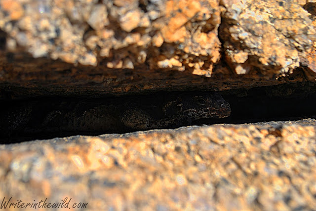
One of those mountains is called Pinnacle Peak, located on the outskirts of Scottsdale. This park has a lot going for it. For starters, it boasts a wide variety of desert plants that grow in very close proximity to each other, making this a very green spot for a low desert locale. The dense foliage supports a myriad of desert wildlife including snakes and chuckwallas, who have plenty of places to hide in the rocky boulder strewn terrain.

Pinnacle Peak
Chuckwalla

What the park doesn't have going for it, is that its way too manicured, covered with signs and barricades to prevent off-trail travel, and dotted with benches and man-made lookouts. Its like the park service is trying to make it too friendly, and too easy. To me, it takes away some of the wildness of the place. I understand the need to attract visitors to the park, but shouldn't the beauty of the place be sufficient?

Anyway, my friend Jim and I still had a fun hike through some very interesting terrain. We saw a lot of chuckwallas sunning on the rocks which was really cool. I love seeing wildlife, its one of my favorite things about spending time in the woods. Even though we looked for snakes we didn't see any. I'm going on a year-and-a-half of desert living without seeing a single rattlesnake. Its crazy! I really want to see one of those big daddy Western Diamondbacks I've heard so much about... Better luck next time I guess.

Jimbo


Friday, October 4, 2013

Quartz Ridge Traverse

Eventually after spending countless hours in your spot, you have to mix it up a little. In the Phoenix Mountain Preserve I've hiked most of the trails, some many times. I needed to keep my spot fresh. Needed to keep the fire burning so I didn't lose interest.
Looking southeast from Quartz Ridge. 
I came up with a simple plan: Climb Quartz Ridge in the north and hike south along its back until I came down the other end, then catch Trail #8 back to the parking lot. Since the temps have finally cooled some, I didn't have to do this hike in 100 degree weather. With temps in the high 80's, and a slight breeze blowing through the park, I hiked in relative comfort. 

Piestawa Peak
Standing on Quartz Ridge looking west
 Hiking along the spine of the ridge took a lot of scrambling and rock hoping. This area is full of jagged rock that I think is schist. Some areas on the ridge are literally stacked vertically with schist and extremely difficult to cross. Other than small lizards and a turkey vulture, I didn't see much wildlife. The park service claims that both Gila Monsters and Rattlesnakes inhabit this area, but I have yet to see any in a year of continuous exploring.

Try walking over that!
The toughest part of this hike was descending the south end. Of course there wasn't any trail, and the slope was covered in loose rock. Every step sent rocks tumbling down the mountain. I almost bit the dust on multiple occasions, but managed to catch myself just in time. 


Descent

Overall it was an enjoyable hike. I got to see a part of the park that I've never seen before, and am just really happy that I live so close to such an awesome hiking spot.

Monday, September 30, 2013

Granite Mountain


Prescott National Forrest


Prescott National Forest is an area that I've never been too, so when I was invited for a hike up Granite Mountain in the Granite Mountain Wilderness, I jumped at the chance. Granite Mountain of course is the home of The Granite Mountain Hotshots, part of the Prescott Fire Department who tragically lost 19 members fighting the Yarnell Hill fire last summer.

A month before the Yarnell Hill fire, The Granite Mountain Hotshots fought a blaze closer to home. The Doce fire in Prescott National Forest burned 6,767 acres before it was contained, mostly in the Granite Mountain Wilderness. This hike would take us through the burn, and from the top of Granite Mountain give us a birds-eye view of the devastation. 


Burnt signpost at Blair Pass
This hike starts out in a classic juniper-pine woodland following a dry creek-bed from the trailhead near Granite Basin Lake. We followed the easy trail under the shadows of big Ponderosa Pines and huge Alligator Junipers. Peaceful, green and pretty, this area teemed with birds, squirrels, insects, and other wildlife. About a mile in signs of fire become visible on the hillsides, with burnt shrubs and melted prickly pear cactus. By the time we reached Blair Pass the terrain had become scorched and desolate. The ground plants were mostly gone, and the leafless black trees provided no relief from the hot sun. 


The ascent up Granite Mountain was hot without the shade producing trees, but we made do resting behind some of the many giant granite boulders that litter the mountain. Some of these rocks were the size of houses, and I couldn't help but wonder what geologic processes brought them there, since glaciation did not occur at these elevations, and it seemed too high for them to be carried by water... But I'm no geologist, so what do I know?


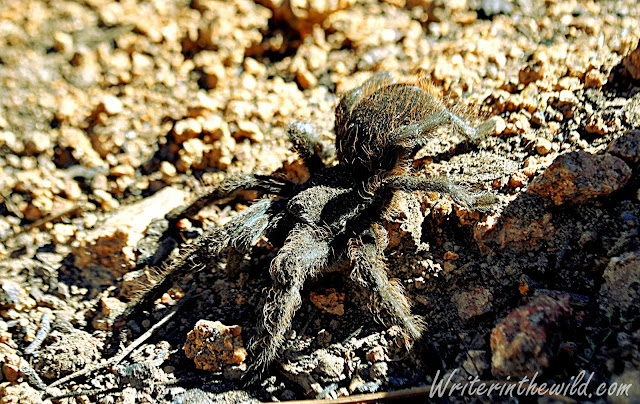
Eventually the trail wound around the northwest face of the mountain, revealing the charred remains of a large ponderosa pine grove. My hiking partner Dave mentioned that this area was previously lush and green, but now it just resembles a graveyard of towering black tombstones in a field of ash and dirt. In this area we had our only close encounter with some local wildlife, in the form of a Desert Tarantula. After my last encounter with a tarantula I read that they were very docile and easy to handle, so I decided to test the theory. I ran my pointer finger down its abdomen to pet it like I would one of my step-daughters rats. Well that's all it took to piss him off, and he immediately reared up its front legs and bared its fangs. So much for docile. He looked way too eager to sink his giant poisonous fangs into my hand if I handled him, so I figured the smart thing to do was just leave him alone.

Granite Mountain
Tarantula

Dave looking out over the burn zone
The top of Granite Mountain opens up into a large bowl-like depression surrounded by huge rock formations on all sides. In this depression stood the remains of another pine grove, but the fire damage here was not as bad, and the ground plants were well on the road to recovery. Eventually the trail brought us out to the south facing slope of the mountain. A little scrambling brought us as close to the summit as we dared, since the last 50 feet is a sheer wall of granite. I'm not too worried about peak-bagging, so I was content with how far we made it, and the beautiful view of Prescott and the surrounding mountains we had.


Looking out over the forest, I couldn't help but think about the firefighters who died, and those that still risk their lives to preserve what little remains of America's wild places. I read once that in the late 1800's, in the heyday of western settlement, some of those who would potentially gain monetarily from deforested land (ranchers, developers, etc), would often light forest fires on purpose. I cant help but think how ironic it is that we sacrifice so much now to preserve what was once taken for granted... How sad it is that we die to save what we once destroyed.

Me looking out over Granite Basin Lake and Prescott in the distance.

Monday, September 23, 2013

Horton Loop

Mogollon Rim
View south from The Highline Trail.

Rim country can be such odd country below the rim. Something I notice every time I visit. Last weekend's overnighter was no different. We started in the shade of towering ponderosas and gnarly alligator junipers on the Derrick Trail heading North/East. The ground was dry and the vegetation sparse, like if you had to go off trail for any reason, it wouldn't be terribly hard to do. But the scenery changed, and by the time we reached The Highline Trail the forest looked quite a bit different. 

Alligator Lizard
Alligator Lizard

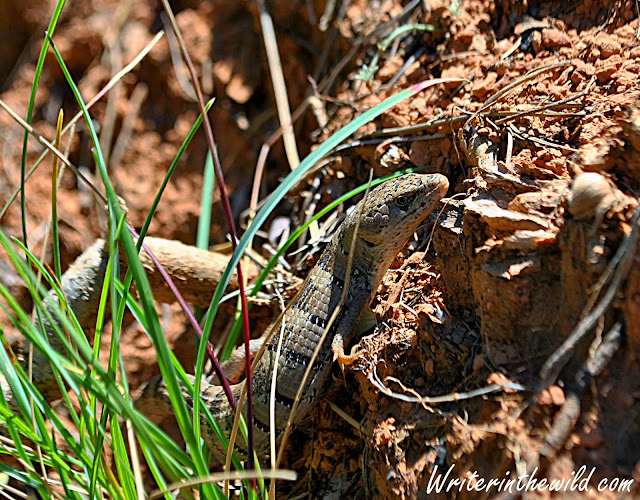
Its like we entered some kind of transition zone. Now the forest was a mix of pines, junipers, and more of the plants you might associate with desert areas like manzanita and agave. In this area we came upon two Arizona Alligator Lizards duking it out in the middle of the trail. Amidst all the biting and squirming and teeth baring, I'm pretty sure it was just a male and a female making ready to get busy (if you know what I mean). I felt bad disturbing the festivities, but it was really awesome to see. It was the first time I had ever seen an Alligator Lizard in my life, and they are just gorgeous looking lizards. We ended up seeing quite a few lizards in this zone, including some really small Short-Horned Lizards that were about the size of a matchbox. They are very skittish at that size, which surprised me because the big ones I've seen are so calm.

Mugollon Rim
Mogollon Rim

Eventually the Highline portion of this trip levels out a little bit, and some nice views of the rim and the mountains to the south open up. 

Ferns

As the trail drops toward Horton Spring the ecology changed again to one more of a purely coniferous nature. Ferns carpet the ground in spots, and lichens grow on the pine trees. I know I've mentioned this before in other blogs about my trips to the rim, but it really reminds me of the Cascades at times.

Descent to Horton Spring

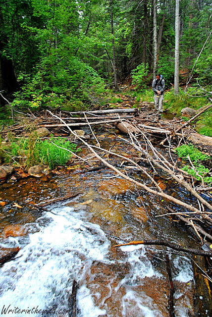
As we neared Horton Spring I could hear the sound of running water and a giant smile spread across my face. Every time I'm hiking parallel to a creek, or nearing a crossing of one, it reminds of the northwest. I rarely ever hear moving water in the woods down here in Arizona, so when I do, I just really appreciate it. Like wind, water makes such a soothing sound, and I love to sleep near it if I can. In fact, that's exactly what we did Saturday night. We camped not far from the mouth of Horton Spring where fresh (and delicious) water gushed right from the side of the Mogollon Rim. 

Horton Spring
Horton Spring

We followed Horton Creek all the way out the next morning. It made for a relaxing stroll, especially because the wind and the clouds kept the temps nice and cool. Overall, it was a great (albeit short) trip with some good company. This was my 3rd (I think) trip with the Arizona Backpacking Club, but everyone this time around was new to me. It didn't matter. It never does with backpackers. We all seem to get along pretty easily... Until next time.

Horton Creek
John looking down at Horton Creek


Wednesday, September 18, 2013

Budget Gear Review: High Sierra Swerve

High Sierra Swerve
High Sierra Swerve


Since I returned to school recently, I was in the market for a new backpack. At first I thought I could use my REI Flash 30 daypack, but a couple test runs didn't go so well. I realized I needed something else. Something without a belt, with multiple pockets for some semblance of organization, and a safe spot to put my laptop. Perhaps more importantly, I didn't want to spend an exorbitant amount of money since I already owned 4 backpacks. I just couldn't justify spending top dollar on another pack.


Like most of my budget buys, I found this pack on Amazon.com. The $35.50 price tag was really attractive, as was the hundreds of overwhelmingly positive reviews. The problem I've found with Amazon over the years, is that the overall star rating (based off average user reviews) can be misleading. People write reviews after one use, or immediately upon receiving the product. Although I always take the star rating with a grain of salt, I decided to purchase this pack because I liked the look, the design, the price, and the fact that it was made by High Sierra, a brand that I had heard good things about.
In this particular case, I found the positive reviews for the High Sierra Swerve to be mostly accurate, even taking into account the low price. I purchased the black/black/black design (I know, I'm lame) but there are plenty of fashionable designs and color schemes to choose from. The pack is made from a fabric called Duralite, which feels more rugged and coarse than the smooth nylon/polyester materials that I'm used to seeing on most higher-end packs. The material just feels tough, like if you snagged it on something sharp it wouldn't rip.

Laptop compartment w/folder sleeve.
The pack seems well made and durable. Indeed, this pack has seen heavy use since my purchase, including 2 semesters of college, and two long road trips over the summer where the pack was routinely jammed into tight spaces, sat on, buried by other luggage, and abused by children. So far its holding up great with no loose stitching, tears, or discoloration of any kind.

The High Sierra Swerve is good for school, work, travel, or day-tripping around town, but is clearly not made for hiking. It has plenty of compartments for organizing your stuff. I particularly like the small zippered top pocket which is perfect for my car-keys, MP3 player, and flash drive. The laptop sleeve is well padded and easy to reach, and my 15.6" HP Pavilion fits securely and safely (so far) inside. That being said, I find the number of zippered compartments to be overkill, especially when it takes me unzipping and searching 3 or 4 compartments just to find what I'm looking for. Out of the 5 zippered compartments the Swerve has, I generally just use 3 for everyday use. That's just me. I can imagine that some of you reading this review would consider all those compartments a bonus.

Top pocket. Great place to stash your phone during class.
It would be really hard to actually fill this pack to capacity, as it just seems deceptively huge. Its like a black-hole that swallows everything that gets too close. High Sierra lists the capacity at 1914 cubic inches (about 31 liters), but I think all the pockets and compartments just make it seem bigger than it is.

I do have a couple complaints that prevent me from being as generous as the customer reviewers on Amazon.

My biggest gripe is that when loaded full with school books and supplies (cuz' that's mainly what I use it for) the pack becomes very uncomfortable. Specifically, the back-padding (also made of Duralite) has a tendency to grab my shirt and pull it up as I walk, so that the padding rubs directly on the skin of my lower back, which can cause a burning sensation that can last for a good hour. Last semester when I had 3 big books, and my pack was really heavy, I was constantly having to reach behind my back and pull my shirt down as I walked around campus. It hasn't been an issue this semester because I'm using e-books, so the pack is much lighter, but last semester it drove me nuts. 

The side mesh pockets are too small, and wont fit anything bigger than a 16 oz water bottle. They are too narrow for anything bigger. Personally, I rarely ever buy bottled water which I consider wasteful and unnecessary. I usually use a Nalgene bottle for my daily hydration needs when I'm on the go, and a Nalgene bottle will not fit into these pockets. Maybe not a deal breaker for you, but If I was shopping for a backpack at the store and came across this pack, I would not have purchased it for this reason.

Lastly, the zippers can be stiff. They slide fairly smoothly in a straight line, but sometimes turning the corners can cause a zipper to stop in its tracks.

If you are on a budget, and need to haul a laptop around, I would consider the High Sierra Swerve backpack for your school and/or travel needs. Its sharp looking, well made, and will certainly get the job done for years to come. Just keep in mind, the back padding is uncomfortable when the pack is heavy, and you'll need to exercise a little patience with the zippers... 

High Sierra Swerve
High Sierra Swerve