Saturday, February 27, 2016

Grand Canyon: Corridor Trails - South Kaibab to Phantom Ranch

The Grand Canyon is incredible. Its enormity inconceivable. Like my last Grand Canyon adventure, I stood on the south rim beholding the great expanse and thought "I can't believe I'm going in there." Over the years I've read plenty of creative adjectives by outdoor writers trying to describe the majesty of a place. The Grand Canyon is the one place where all adjectives fall short, yet every adjective used to describe it is true. 

Descending South Kaibab
We got an early start. The bus that left the backcountry office at 7 am was packed full of tourists. At the trailhead we donned microspikes while a cow elk fed in some junipers not 20 yards away. The trail was a mix of snow and ice, so the microspikes were a must. The Grand Canyon is not a place you want to fall. The views were spectacular from the start. Especially up high, as both rims were covered in snow. The Canyon can spoil a hiker with views real quick. Huge monolithic rock formations and giant cliffs everywhere you look. 

Leaving the snow behind.


This hike was very different then my previous trip on the Royal Arch loop. In Royal Arch we saw perhaps five people in five days of hiking. On the South Kaibab we saw several dozen on the first day alone. Apparently the traffic is even thicker during the shoulder seasons. We passed guided tours, day hikers, pack trains of mules, trail runners, rangers, and even maintenance crews working on the trail.


By the time we reached the river (and 4860 ft lower than we started) the crowds had thinned out and we were ready to camp. Our permit was for Bright Angel campground, which is just up the trail from Phantom Ranch. We managed to drop our packs and run into Phantom Ranch for a couple beers before the 4:30 closing time. It's weird to see so much civilization at the bottom of the Grand Canyon, and although I had mixed feelings about it, I sure enjoyed the ice cold beers after a long day of hiking.

First good look at the Colorado River
Our camp spot was tiny so we pitched our tents practically on top of eachother. Instead of a tent, I was using my tarp. I had been concerned about being cold at night since all I had was a 30 degree bag, and the temps were supposed to dip into the mid-20's, so I had brought a bivy to pair with my bag and sleeping bag liner. I went to bed with all my clothes on and had a restless night's sleep. Not only was bag not warm enough but the pad I used had a low R-Value and I could literally feel the cold seeping through the pad at night. When I finally crawled out of bed around 9 am the next morning, my down sleeping bag was soaking wet from condensation. I knew that condensation would be an issue with the bivy, but I didn't realize just how bad it would actually be... To be continued.

Our camp at Bright Angel Camp
Bright Angel Creek

Tuesday, February 9, 2016

Bloody Basin Coues Deer Hunt


Coues deer country
Picking Bloody Basin for our archery hunt was an easy decision. Although close to Phoenix as the crow flies, the poorly maintained forest roads and rugged country keep the masses away. Plus, Bloody Basin is classic coues country: high desert creosote scrub lands with plenty of juniper, mesquite, palo verde and prickly pear cactus. Bloody Basin is vast but the people are few. After last year's failed mule deer hunt in the Cave Creek region of Tonto National Forest, we resolved to do plenty of scouting this time around. Our scouts in Bloody Basin revealed lots of deer. Glassing opportunities abound in Bloody Basin, and we spotted groups of coues bucks on multiple occasions. One such group was a bachelor herd of around 5 or 6 young bucks. We spotted them bedding and feeding on the same hillside on multiple occasions. It was this group that would be the focus of our hunt.

Glassing
From our camp at Red Creek we reached a position to glass the hillside at first light. We immediately spotted two coues does feeding near the same spot where we spotted the bachelor herd in our scouts. Since it was now the height of the rut, we assumed that the bachelor herd would be split up, which seemed to be the case since we never saw any herds with more than one buck. We watched the does for most of the morning, and when they were bedded, decided to take a closer look. They were bedded on a hill just below a ridgeline. This ridgeline would prove to be the focal point of our hunt for 4 of our 5 days in Bloody Basin. The topography at this location was challenging because on the ridge was a mesa that could realistically only be accessed from two sides due to the giant cliffs that surrounded it.

Red Creek camp
Early afternoon on the first day we spotted a large buck chasing a group of does at the base of our hill. It was the first time I've ever got to see a rutting buck, and I felt like I was part of something special having the privilege to witness it. We were chomping at the bit and the day was disappearing. We decided to put on a stalk. The wind was in our favor as Jim and I split up to find the buck. I climbed to the base of the hill while he stayed low, in the hopes that one of us would be in a blocking position if the buck spooked. I put on my best desert ninja impression. I walked carefully and deliberately. I glassed often. Jim spooked a doe. The sun set behind the mountains. We returned to camp.

Hiding
 Day 2 was more of the same, minus the buck. We spotted a doe at first light feeding in the same spot we stalked the buck the night before. Thinking that maybe the buck was near but bedded down, we crept to about 130 yards from the wary doe. She eventually bedded behind a prickly pear in a thicket of juniper. We were in great position hiding amongst some junipers on an adjacent rise, and we watched her undetected from pretty close. I could have sat there watching her all day.

Next morning the buck we were after skylined himself on the ridge at first light. Wasting no time we scampered up the backside like we had on day one. We were moving quietly and the wind was in our favor as we passed some old ruins from a time when Indians hunted these lands. I felt like we had a real chance of getting that buck. Unfortunately we rounded a bend and found our route blocked by a herd of grazing cattle. Since they weren't moving and our day was wasting away, we decided to just walk calmly by them. The huge cliff that I mentioned previously prevented us from taking a more circuitous route. As soon as the cattle saw us moving toward them they spooked. There were probably only ten of them, but they thundered up that hill straight toward the area we spotted the buck. We were too committed to the stalk to just give up so we continued moving forward, but inside I felt like the buck was long gone... and it was.

Near where we spotted the buck from the valley to the left.
Jim glassing from the ruins on day 3
 That turned out to be the closest we ever got. Day 4 was spent glassing from sun-up to sun-down without seeing anything but a couple red tailed hawks circling overhead. Our buck was seemingly spooked for good. The morning of day 5 we switched locations all together. We had glassed 4 bucks scouting this new location and caught a 3x3 in a game cam (the other 900 plus photos were all cattle), so we were reasonably confident we would see some deer. The new location was farther south, and the terrain radically different and vastly more difficult to hunt. Catclaw (also called "wait-a-minute bush") covered this area. If you've never ran into catclaw in the desert before, count yourself lucky. It is one vicious plant. It was so thick that it literally stopped us in our tracks on more than one painful occasion. It ripped our clothes and our skin, and made any attempt at stealth impossible. Where there wasn't an obscene amount of catclaw, it was instead thickets of scrub oak, which really aren't any better. Surprisingly, we spooked a bedded buck from about 15 yards away. It shot like a dart across a field of catclaw bounding over the thorny vines like some kind of desert acrobat. That buck literally covered 100 yards in the blink of an eye. It stopped on a catlaw covered hill and hid behind a prickly pear. We glassed it for a few minutes while trying to formulate a plan. Because of the dense catclaw and scrub oak, by the time we reached the hill that buck was long gone.
Jim and I on the last day. It's hard to tell but all those bushes behind us are the dreaded catclaw.
Even though we came up empty handed, we certainly didn't come out empty headed. I felt like I learned a ton about hunting on this trip. If you follow my blog, you'll know that this is only my second hunt ever. From what I've read, hunting coues deer with a bow is considered one of the most difficult hunts in the world. Maybe I was little too ambitious in planning this trip, but frankly, I still feel like I could have got one. I feel like I have what it takes. More than anything, it's about putting in the time, which is what I just don't have a lot of. This may be my last coues deer hunt ever as I am moving to Oregon in the Spring. That little whitetail taught me a lot in those 5 days, and I hope to carry on the knowledge... By the way. In 5 days of hunting in Bloody Basin we saw a grand total of 3 people, and none of them were hunters. We had the place to ourselves.


Monday, January 25, 2016

Mecca Hills: Painted Canyon Ladder Hike

Entering Painted Canyon
 Jutting upward from the San Andreas Fault just across I-10 south of Joshua Tree National Park is the incredible Mecca Hills. These hills are some of the most unique geologic rock formations I've ever seen. In fact, driving through them reminded me of a set from the original Star Trek. I almost expected to spot a Gorn on one of the jagged hillsides who would (of course) promptly hurl a giant boulder at our car, because that's what Gorns do. The Mecca Hills are beyond barren. There is little plant life and no sign of water. It's the kind of place you really don't want to be stuck in.
Looking for the slot canyon entrance.
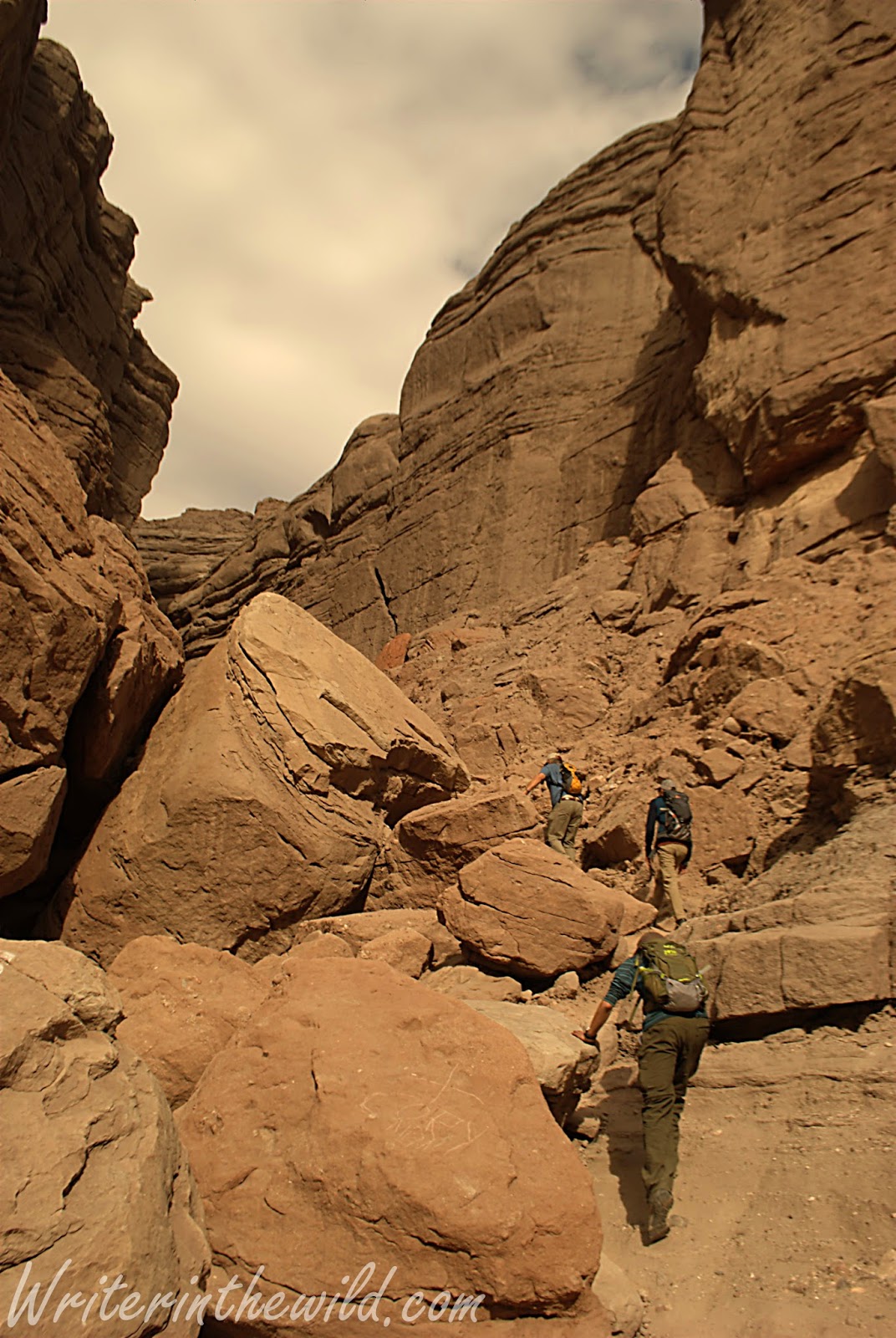
Despite the remote feel of the locale, the trailhead at Painted Canyon was packed full of vehicles, and in typical southwest style strewn with trash and broken bottles. We were immediately barricaded on both sides by towering rock walls as we started the hike. I tried my best to ignore all the graffiti littering the walls as we hiked in deeper. We were looking for a slot canyon known as "The Ladder Hike" that existed somewhere within the larger canyon, but lacking a very detailed map, we weren't sure of its exact location. Eventually we reached an arrow on the ground built from stones that pointed to a mass of boulders that evidently led to the slot canyon. If we hadn't seen the crude marker on the ground we would have passed unknowingly by, as the junction lacked any signage and took some scrambling to reach. 


The walls closed in around us. Once we made the slot canyon the entire hike changed. Some places light didn't reach. Others we had to slide through narrow rock passages. Ladders placed throughout the canyon created a really unique hiking experience as we dropped deeper inside. Although I had a great time, I felt quite uneasy at times in that little canyon. A rock slide from the top could easily have trapped us. We had anticipated a view of the Sultan Sea once we reached high ground, but rain clouds moving in from the distance convinced us to turn around and cut our hike short. Flash floods are dangerous, and in that little slot canyon there is virtually no way out.
Greg descending a ladder deeper into the canyon,

Mecca Hills

Saturday, November 28, 2015

#OptOutside: Needle Rock Beach

Needle Rock Beach
 I had four helpings of Thanksgiving dinner. The turkey was so moist and golden brown that I couldn't help myself. The sweet potato casserole was delicious. Friday I felt flat. I was ready to spend the day on the couch, watching old Christmas movies, and eating leftover pumpkin pie. Sarah got the family motivated, despite my reluctance to move, and soon we were packed in the car headed for the Verde River.

Hiking along the river
 I couldn't figure out why it was called Needle Rock beach. There were no big rocks shaped like needles, though I could see Weaver's Needle from the road, stabbing upward from the rugged Superstitions. It reminded me of my backpacking trip there last December, and suddenly I wished I was back, camping in the shadow of the needle under a billion stars. The kids don't know it, but I am buying both of them backpacks for Christmas. It's all part of my plan to spark in them a love for backpacking and the outdoors. My hope is that nature is creating impressions on their brains that will forever connect being outside to fun and happiness. 


Fishing at the beach didn't go well, so we followed a faint trail on the river's edge. Riparian areas like this are so unique because the ecology on the river is so different than the surrounding desert. One minute you're walking under the shade of cottonwoods, and the next your surrounded by cacti on a sunswept hillside. 


My family.
 We found a secluded little spot about a half mile from the beach that looked suitable for camping. There was already a firepit and an area for a tent. The best part was that it was located at a spot on the river that was really deep and heavily wooded. I think I'll take the kids there on their first backpacking trip.

Although I've never shopped on Black Friday before, I think I'll make #optoutside an annual family tradition. It's important to teach our kids what is really important in life. Nature has real value. Family has lasting meaning.

Until next time....


Thursday, November 19, 2015

Joshua Tree National Park: 49 Palms Oasis

Stairs to 49 Palms
 After a night of beer swilling and cigar smoking around the campfire at Jumbo Rocks, Saturday dawned too soon for me. But I knew from past experience that nothing cures a hangover faster than a hard day's hiking. When we pulled the van into the 49 Palms Oasis trailhead, I knew this trip wouldn't be like the Maze. For starters there was a trailhead and a sign. There were also probably 20 vehicles parked there too. Today we would have company... Damn.

Descent into the Oasis
 This area of the park is quite different than where we camped at Jumbo Rocks. There are no Joshua Trees here. In fact, it reminded me of Squaw Peak in Phoenix. A lot of of rocks and creosote, and not much else. The lack of shade would have been a problem if we weren't already intimately familiar with desert hiking. I imagine it could be a problem for park visitors from parts further north. After a 300 foot climb we were rewarded with views of the city of Twentynine Palms, and a teaser of the fan palm oasis that was our goal. The lush green palm grove in the middle of brown barren desert looked so out of place. In Arizona, where I live, palms aren't native to the desert, so outside of the city you just don't see them.

Checking out the palms with my binos.
Approaching the oasis.
 When we reached the oasis we unintentionally crashed a midday Boy Scout party. There were 15 to 20 preteen boys and 5 adults. The boys were sprawled out on a huge boulder jabberjawing, while most of the adults were lazing about in the shade. Two of the adults were exploring the oasis past the signs that implored hikers not to travel any further because of the "sensitive ecological area." Apparently disregarding signage is a favorite pastime of some 49 Palms Oasis hikers as at least a half-dozen of the palms (that I saw) were covered with graffiti in the form of really bad carvings. Greg, Chad, Victor and I found a spot in the shade and talked about how cool the oasis was while snacking on beef jerky and gorp. For all of us, it was the first time seeing such an oasis, and I remarked to the guys how much fun it would be to overnight there. It was the only spot in three days at Joshua Tree that we saw water.

Hanging out at 49 Palms Oasis
Despite the traffic, 49 Palms Oasis was a cool little hike. I just wish it was about 5 miles longer to discourage the riffraff, and I don't mean the Boy Scouts. The  park rates this hike as "moderately strenuous", but for us it felt like a literal walk in the park. By the time we returned to the van at the trailhead the day was half over, and we were thinking of a place we passed on the road through the park called Hall of Horrors. Who wouldn't be intrigued by a name like that? Stay tuned.

Monday, November 16, 2015

Joshua Tree National Park: The Maze

Searching for the trail in The Maze
 Joshua Tree National Park is known as a climber's park. The rocks are big, easily accessible and there are plenty to choose from. Our visit to Joshua Tree was a mission of discovery, and that meant throwing on our packs, topping off water bottles, and hitting the trails. Our first stop was a trail called "The Maze". Peculiarly, it wasn't listed on our map. We stopped at the Cottonwood Visitor Center beforehand where a Park Ranger drew an "X" on our map. "We don't advertise the Maze," said the ranger. Apparently too many people get lost there.

Still looking for The Maze trail.
 We reached what we thought was the parking area the ranger directed us to, and set out toward rock formations in the distance. We weren't sure if we were in the right place, because although The Maze is an official park trail, there is no official trailhead or signage of any kind. When we reached the rock formation I turned around and took a bearing with my compass to the van to be safe. The Maze, like the rest of Joshua Tree, is a desert. And like the Sonoran Desert that I'm used to, trails can be hard to find because the ground is covered in sand everywhere. We picked a direction we thought looked good, and ventured on.

Looking for a trail
I was a little hesitant charging off trail in a place called the Maze. Route finding was challenging because the entire area is covered in huge boulders and rock formations that looked like literal mounds of piled rock. Between these rock piles were dozens of dried washes that could easily be confused for trails. The landscape was otherworldly. In fact, it reminded me of Mars (minus the plant life of course). Coming from Phoenix, much of the plant life was familiar. There were plenty of cacti and agave. But it's the bizarre Joshua Tree that really made it feel strange. The animal life was plentiful as well. We saw a coyote, a jackrabbit, a tarantula, and sheep tracks in a wash. Eventually we reached a high point with great views of the area where we finally spotted a trail. 

The Maze
Joshua Tree
 The trail we found led us to a sign that told us we were on the Maze Loop trail. It began by following a dry creekbed through lush desert vegetation. We wound around boulders and over saddles on rocky hills. The trail eventually took us high enough to give us some picturesque views of the park. The rocky landscape stretched to the horizon, and stirred my imagination and desire for exploration.

Finally on the trail.
Views
 As the sun sunk low on the horizon we began to wonder if we had lost the trail. We hadn't seen any other hikers since we started, and the footprints in the sand that we had been using as directional ques were gone. In the distance we spotted a truck and realized that we had unwittingly looped back to the road. My compass told me that we were way south of where we parked the van, so we left the trail (which we weren't sure was a trail anyway) and parallelled the road back to where we started.

Back to the van off trail.
I'm not sure how long this hike is supposed to be, but we guessed that we had done 6 or 7 miles. Probably half of that distance was off trail. The landscape was beautiful and the hike was moderate as far as the difficulty is concerned. The toughest part was just figuring out which way to go. During the hike we only saw 4 people, which turned out to be the least amount of people (by far) we saw in the park during our whole trip. For me it was an amazing introduction to Joshua Tree National Park, and I couldn't wait for more.

Monday, November 9, 2015

Sugarloaf Mountain Scout

No water in Cave Creek
 With archery deer season a month away I've been itching to get outside for some scouting. I returned to the spot in Tonto where I put a stalk on a large mule deer buck last season. There's so many places here that I want to explore, and Sugarloaf Mountain has been on the top of the list. This time of year the desert is so nice. The heat is a shadow of its summer self. This area is a favorite of mine, partly because of its location to my house, but also because Cave Creek provides a reliable source of water in the desert, which is a rarity. So, I was shocked when I reached the creek and found it bone dry. The usual clear flowing water replaced with a bed of sand and dry cracked mud. I've been here over 20 times in the last 3 years, and I've never seen it dry. 

Coyote or lion?
 The dry creek bed offered me a rare chance to experience the area's wildlife in a whole new way. I saw dozens of tracks dried in the mud as I abandoned the trail and walked north in the creek as it wound further into the mountains. I spotted plenty of bird and rodent tracks, but no deer. I also saw what I originally took to be lion tracks, I was sure they were lion as I followed them along the bed, but after I got home and studied the photos I now believe they belong to a large coyote.

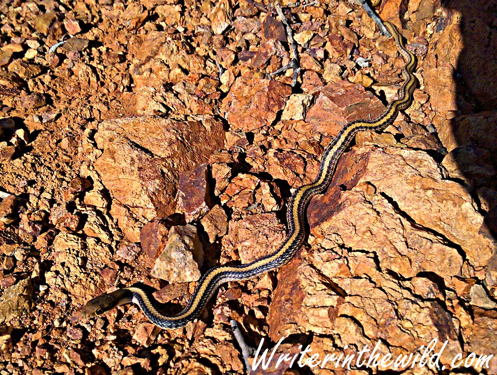
Garter Snake
I slowed down as I reached the approach to Sugarloaf where I saw the buck last season. It's hard to be quiet in the desert, and my footfalls were crunchy on the loose rocks. I almost stepped on a snake that was crossing the ground in front of me. I love seeing any kind of wildlife in the desert, so even a common garter snake will cause me to pause and just watch for awhile. Climbing up a nearby mountain was slow going, The country here is rough and rocky, and full of all manner of cacti. My pace was slow as I navigated the terrain, while trying to stay quiet and watch for rattlesnakes. Finally I reached a good spot with views of the valleys and hillsides surrounding Sugarloaf. I sat on my pack and glassed the day away with my new binoculars. I picked up a set of 10x42 Alpen Wings to replace my old Bushnells. They looked great in the store, but out in the field they just don't seem to be as good as I hoped. 

It was a fun and productive day. I didn't spot any deer or see any sign other than a few old tracks. Certainly, I didn't see anything to make me believe that deer of any number are in the area. I didn't even find any scat. Before I cross the area off my list as a potential hunting location I think I need to spend the night out there so I can glass at dusk and dawn. Such a trip is at least a week away however, as I am heading to Joshua Tree for three days on Friday. Stay tuned.