Showing posts with label hiking. Show all posts

Monday, April 30, 2018

Footwear: Go Light, Go Longer.


With the amount and variety of hiking gear available, sometimes choosing the right equipment can be a daunting task. We spend countless hours on the web comparing gear and prices, and reading reviews to find the perfect pack or sleeping bag or shelter. The options are limitless. Do we want an internal or external framed pack? Do we need a frame at all? What size? How many liters? What about a shelter? Should I buy a freestanding double-walled tent, or go with something lighter I have to stake out like a tarp? Do I need the footprint? What about bivy sacks and hammocks? I need a sleeping bag too. Should I buy down or synthetic? What about the temperature rating? Does it need to be water resistant? Should I get a quilt instead? 

The questions are many, and finding the answer that works for you can take a ton of research. 

When it comes to footwear however, that process is often times ignored. We already know what footwear we need, no doubt imbedded into our sub-consciousness from years on the trail… 

We need boots. Heavy high-topped leather boots with great traction, ankle support, and a Gortex membrane to keep our feet dry. Since we already know we need boots, buying them is much simpler. We walk into the outfitter and try some on. We pace around the shoe department and maybe make a few laps up and down the stairs. When one pair stands out above the rest as the most comfortable (or least uncomfortable), we fork over a couple hundred bucks and walk out the door. Done deal right? 

Not so much. 

Our feet hurt, and blisters are forming on our heels and toes. Instead of admitting defeat in our choice of footwear, we spend more time and money treating the symptoms. We buy expensive insoles. We use sock-liners, or better yet we double-up on heavy merino-wool socks. We apply moleskin at the start of the hike in the spots we’re blister prone. We take our boots off on breaks, and sometimes even stop mid-hike to change socks. We carry an extra pair of shoes so we can ditch the boots the moment we reach camp because our feet are screaming. In extreme cases we might take our boots back to the outfitter… and exchange them for other boots. I’ve seen it. I’ve done it. I’ve been there. 

This is the way of the hiker; blisters, foot pain, and miserably sweaty feet… But it doesn’t have to be. There exists an effective yet simple alternative... 

Shoes. More and more, hiking shoes and trail runners are replacing boots as the footwear of choice for hikers. 

Most of the time when choosing new gear, weight is a prime consideration (if not, it should be). Even though our backpack is designed to carry 50 pounds, that doesn’t mean we want it to. We are all acutely aware of the pain inducing affects a heavy pack can have on the body… But what if I told you that weight on the feet is actually worse for you than weight on the back? You’ve probably heard the adage that 1 pound on your foot can equal 5 on your back. Well, in terms of energy expenditure, it’s basically true. A US Army study concluded that walking with one pound on the foot expends the same amount of energy as carrying 6 pounds on the back. When you realize that boots can weigh 2, 3, or even 4 pounds, that’s a ton of energy your body is needlessly burning with every step, and fatigue will come much quicker. In The Backpackers Handbook world re-known long distance hiker Chris Townsend writes, “That lighter footwear is less tiring seems indisputable.” 

Shoes aren’t only lighter, they are more comfortable. Thinner synthetic construction and an abundance of mesh ensure good airflow, reducing moisture and the chance of blistering. Flexible soles give your feet the freedom to move naturally, instead of being stuck in the same position for miles on end. The result is that your feet are comfortable longer, making those long hikes more doable than you ever thought. Again, Townsend writes that heavy boots, “make my feet ache after about 12 miles, and after 15 miles all I want to do is stop. Yet in running shoes I can cover twice the distance before my feet complain.” I had a similar experience. On a 12 mile day, hiking fast to beat the darkness, my feet were killing me in my boots. Every step was agony. The pain was so bad I just wanted to quit. I bought a pair of trail runners the next week. Later that summer on a 50 mile mountain trek in central Idaho I hiked faster, with no pain or blisters, all while carrying a much heavier load. I was sold. 

In my experience, the most common reason people say they prefer boots is the need for ankle support. It stands to reason that the rigid boot construction would provide more stability for the foot, and minimize the risk of ankle injury. I however have noticed a dramatic decrease in the amount of ankle problems since I switched to shoes. This is because I step more carefully in shoes, knowing my feet are potentially more vulnerable to slipping, sharp rocks, and other trail hazards. Indeed, it is this lack of protection that is the real trade-off. 

It all comes down to personal preference, and what your specific needs are on a given trip. I find boots still my footwear of choice hiking in snow, or multiple days of rain. The prevailing theory among shoe enthusiasts is that trail runners dry so quickly that getting them (and by default your feet) wet is not something to avoid, which is fine for a stream crossing on a sunny day, but if the forecast for your weekend trip is calling for non-stop rain, then you probably don’t want to spend that time with soaked feet. Like with any gear purchase, do your homework. There are many options between trail runners and heavy leather boots. Brands like Merrell, Keen, and Salomon offer shoes with the benefits of both: low-profile, synthetic materials, plenty of mesh, Vibram soles, and even Gortex. Again, do your research. There are tons of resources online, and lots of great books written by people with thousands of trail miles under their belts. Before you buy don’t forget to stop at your local outfitter and try some on. Pace around the shoe department, and maybe make a few laps up and down the stairs…


This article was modified from a story published a few years ago on the now defunct Mountain Blog. All the work is mine.

Monday, March 12, 2018

Top 5 Most Extreme Ultralight Backpacking Tips


I heard a story once about a first-time backpacker whose load was so heavy he began ditching his gear in the woods not even a mile in from the trail-head. He threw out his frying pan (but kept the pot), a lawn chair, a pint of Jim Beam (he took a drink first), a 15 million candle-power spotlight, and a field guide to flora and fauna of the Pacific Northwest (hardback of course). He learned the hard way what all of us experienced backpackers already know: carrying a heavy pack sucks. 

Many backpackers (including myself) have endeavored tirelessly to lighten the load, to ease the burden on our weary bones as we burn through the miles. One of the best ways to lighten up is to swap out your backpack, shelter and sleeping system (collectively known as “The Big 3”) for lighter counterparts. The problem is, good gear is expensive, and it seems the less an item weighs, the more it costs. Consider Hyperlight Mountain Gear’s Ultimade 2 pyramid tent. Made of Cuben Fiber, it only weighs 19 ounces, but costs a whopping $715.0... Yikes! 

In lieu of spending your entire savings account replacing the Big 3, there are other, shall we say, more unorthodox methods of getting that pack weight down. In my attempt to go lighter I have run across some strange stuff that people will do to shave ounces, (because as we all know; ounces equal pounds, and pounds equal pain!). I'm not referring to the more commonly known techniques like cutting the handle off your toothbrush or removing the backpack lid. I'm talking radical, cutting edge stuff so extreme that I don’t have the courage to try them out myself. I don't have the time or the space to list them all here, so I've decided to just present the top 5. Remember, I don't endorse these techniques, I'm just passing along the information strictly for informational (entertainment) purposes. 


Go Stoveless – I met a guy last year who thru-hiked The Arizona Trail without a stove. He ate cold dinners, and never enjoyed a morning cup of coffee. I know, it sounds terrible, but on a long-distance hike you could save some serious ounces by leaving your camp kitchen behind. On an overnighter however, you won’t have any reason to get up in the morning.

Don't Treat Water – No filter, no chemicals, no problem… right? This movement is picking up steam within the cult-of-ultralight. The theory goes that with experience you should be able to distinguish safe from unsafe water sources. While leaving your water treatment devices at home can potentially shave a few ounces (2 with the popular Sawyer Mini), is contracting the dreaded Beaver Fever really worth it?

Swap the Knife for a Razor – Apparently some gram weenies out there actually think a razor-blade is not only a perfectly good substitute for a knife (shhh, don’t tell Dave Canterbury), but “the ultimate in ultralight backpacking knives,” as one blogger put it. When I'm in the woods, I like to imagine myself as the second coming of Daniel Boone, so for me, not carrying a knife just doesn’t cut it.

Trim Your Zippers – An old backpacking buddy of mine (who shall remain nameless) told me once that to shave weight from his pack he trimmed all the pull tabs from the zippers on his gear. Now, I've heard of trimming the straps off you pack, or cutting the tags off your clothes, but cutting the pull tabs off your zippers? How much weight will that actually save? Needless to say, he had a tough time getting in and out of his tent.

Don't Bother with Toilet Paper – I found this gem in Mike Clelland's book “Ultralight Backpacking Tips”. The book is loaded with useful information for backpackers trying to go light, but when I came to tip number 116, I did a double take. “Liberate Yourself From Toilet Paper” the tip reads. Instead of TP, he recommends wiping your hind quarters with snow, leaves, pine-cones, sticks, and even rocks. I haven't tried any of these advanced ultralight techniques yet, but I will say that if you leave the toilet paper at home, lightening your load will be more important than ever.


This article is my original work. It was adapted from a piece I did on the now defunct The Mountain Blog called "Do What with a Rock". 

Tuesday, June 20, 2017

Budget Gear Review: Kangaroo Outdoors Rocky Mountain Trekker

Rocky Mountain Trekker in the wilderness


The Dirt:

Kangaroo Outdoors Rocky Mountain Trekker 

What is it? Mummy style backpacking sleeping bag.

Comes with: Sleeping bag, compression stuff sack.

Weight: 3.1 pounds (in stuff sack)

Temp Rating: 32 degrees Fahrenheit

EN Rating: No

Materials: Rip-stop nylon

Insulation: Synthetic
.
The Rocky Mountain Trekker is a budget friendly lightweight mummy bag for 3-season backpacking. I was contacted by someone from Kangaroo Outdoors to write this review, and I have to say that Kangaroo Outdoors, the company, is a bit of a mystery. They don't have a website, and as far as I can tell, the only product they make is this sleeping bag. Regardless, the product description on Amazon assures us that "Kangaroo Outdoors is committed to bringing you only the highest quality outdoor gear. We design and test all of our items in the high Rockies of Colorado." Due to the lack of information on Kangaroo Outdoors and the Rocky Mountain Trekker online, this review will be entirely what I've observed through use.

Pulling it from the box, the first thing I notice is the size. In the provided compression sack, it packs pretty small. Without the compression sack however, it's bulky. In fact, I had trouble stuffing it in a 50 liter backpack on a recent outing. The weight isn't bad either.... for the price. Granted, today's higher end 30-degree down bags barely bust the 1 pound mark, but they are hundreds of dollars. At around 40 bucks, 3 pounds is pretty damn good, and certainly an acceptable weight for most weekend backpackers. On short trips, the weight is barely noticeable. And that's really what the Rocky Mountain Trekker is for, short trips for casual backpackers who don't want to break the bank.


The concern with buying a budget bag is always materials and craftsmanship. Kangaroo Outdoors lists the bag material as rip-stop nylon, but doesn't list a grade. Insulation type is synthetic, but doesn't say what kind. The truth is that the materials make it feel like a forty dollar sleeping bag. But it performs. On multiple backpacking trips when the temperature flirted with freezing, I always stayed warm. Granted, I was wearing baselayers and using a bag liner, but I always do, even with my Marmot and Nemo bags. On breezy, chilly, rainy nights, The Rocky Mountain Trekker continued to surprise me. Even when a chill crept in, I was able to cinch the hood and draft tubes to effectively trap my heat in. This bag does not have a European Norm rating, but the claimed 32 degree comfort rating seems pretty darn accurate.

Rocky Mountain Trekker

Like budget bags I've owned in the past, the biggest problem I had was the zipper. It didn't completely burst open like my last budget bag did, but I fought with it in the night, every night. For starters, snagging was an issue. I found completely zipping up the bag was a challenge and a chore. Even more annoying was the tendency for the zipper to unzip itself during the night. Strangely, pressure on the underside of the zipper would cause it retract. As a result, unless I had the zipper completely up and secured with the Velcro strap, it would retract during the night and I would wake up exposed. 

Overall, The Rocky Mountain Trekker is a solid 3-season bag with an affordable price tag. I would recommend it for new backpackers or anyone who can't afford a name-brand bag. For the experienced or constant backpacker, I would give it a look only if money is a serious concern for you. Otherwise, it would make a good loaner or backup. Durability may be an issue. After all, I don't know anything about materials or manufacturing. I couldn't find any warranty information from Kangaroo Outdoors either. But then again. it's only a 40 dollar bag.

Disclaimer: I was given this sleeping bag for the purposes of a review by Kangaroo Outdoors at no cost to myself. The opinions and conclusions reached are strictly my own.

Wednesday, February 22, 2017

Smith Rock State Park: Wolf Tree Trail

Smith Rock State Park
Wolf Tree Trail

The famous Smith Rock State Park. A local favorite. A climbers dream. A place I'd never been, until now. It was a sunny Saturday morning and we chose a less popular path, Wolf Tree Trail. The trail follows The Crooked River and quickly drops into a delightful juniper/ponderosa pine woodland. The masses don't seem to go this way. Except for the sound of the rushing water it was quiet. Close-up views of the giant rocks that make this place famous parallel the trail (for a close-up of the climbing, bring your binoculars). 

Crooked River
While short and easy, Wolf Tree Trail does offer some options for extending your hike. I recommend the short Burma Road Trail. While steep and exposed, the views at the top are jaw-dropping. From there, connect to the 7.5 mile Summit Loop for a walk around the entire park, or turn around to head back to the trailhead.

Smith Rock State Park
Descent from Burma Road
The Wolf Tree Trail, with The Burma Road side trip, is an easy three mile in-and-out. For me it felt like a teaser. Although satisfied with the views, I found myself wanting more as I climbed back out of The Chute to the parking lot. It's a small park. An ambitious hiker could hit every trail in a weekend trip. I'll put that on my "to-do" list.

Smith Rock State Park
Talus slope

Sunday, January 29, 2017

Oregon Badlands Wilderness: Flatiron Rock

 In the midst of the worst winter central Oregon has seen in 25 years, finding a place to recreate can be a bit of a challenge. Mainly because unplowed roads promise misery for the unprepared driver. I don't want to join the ranks of the many snowbound vehicles I have seen on forest roads in the last couple weeks. So I head to the Badlands. Flatiron Rock trailhead is literally just off the highway. I don't have to navigate any treacherous forest road to get there. I just make a left from U.S. Route 20, and boom, I'm in the parking lot.

Ancient Juniper
A couple route options exist from Flatiron Rock trailhead. We combined Flatiron Trail with Ancient Juniper Trail to form a 7 mile lollipop loop. The scenery in the Badlands doesn't really change, no matter what part of the wilderness you're in. It's relatively flat and covered in old gnarly Junipers (some over 1000 years old), but Ancient Juniper trail had some of the biggest Junipers that I've seen in the wilderness. Some were old and dying and others lush and green. We noticed several were cut with saws, including the Juniper in the photo above. It looked like someone cut a V into it with a chainsaw and then just walked away.

Jonah
 Flatiron Rock is much more discreet than its neighbor Badlands Rock to the east. It doesn't stab upward like Badlands does. Nevertheless, the views from the top are almost just as impressive. From the northwest corner of the rock the cascade range was clearly visible as far north as Hood. I've heard that Flatiron Rock hides a lot of little caves and crevices ripe for exploration, but the amount of snow made finding such places impossible. 

Views of the cascade range.

As usual in the Badlands, we didn't see many people. We also didn't hear any birds... like at all. It's weird because if you read my blog regularly you may recall that I'm constantly remarking about the huge number of birds I see and hear in the Badlands. In fact, since my last visit I've read that the Badlands and surrounding desert host over 100 different species of bird. Today however, I didn't hear a peep. Maybe they were all hunkered down trying to stay warm. 


Hike out


Monday, January 23, 2017

China Hat: Bessie Butte

China Hat is a spot that I've been wanting to explore since moving to Bend last summer. I've heard people talk about it a lot, seemingly because China Hat hosts any activity under the sun (and moon), including hiking, caving, camping, snowmobiling, skiing, shooting, hunting and unfortunately even dumping. The drive is easy from Bend. From my place I can be on China Hat road in 5 minutes. The drive out to Bessie Butte will depend on the road conditions, but is generally around 10 minutes upon reaching China Hat Road (in winter it can be sketchy because the road is not plowed). This ease of access is one reason this area is so popular. The other reason is that it seems far less regulated than other national forest lands in the area.

Three Sisters in the background.
In a land formed by lava and dominated by buttes, Bessie Butte is not one of the tallest. It does however stick out like a sore thumb due to a fire a few years back that really thinned out the plant life immediately surrounding it. Because of this, from the road Bessie Butte appears much larger than the surrounding buttes. We had the trail to ourselves as we made our ascent in freezing temperatures and a bitter wind. I was immediately struck by the absolutely eye-popping views. Even in winter the 1.5 mile hike to the top was easy. On this day we didn't need snowshoes or traction devices, but sunglasses and a beanie were a must. But those views!! It was a perfectly clear sunny day and those Cascades were majestic.

Almost to the top.
At the top the views were even better. Mount Bachelor, the Three Sisters, Jefferson and even Hood were all clearly visible. Literally, on that fine day, we could see as far as the eye could see in any direction. It was totally awesome, and one of the best views I've had in Bend thus far. 

View east from Bessie Butte summit.
The top of Bessie Butte is big. We saw a couple fire rings and I thought it would make an excellent spot to overnight. The views at dawn and dusk would be totally epic. We also saw a rock pile and a makeshift cross fashioned from twigs. The dogs took a keen interest and were trying to overturn rocks to get at whatever was underneath. I guessed the grave contained someone's pet, but who knows. Regardless, I cant think of a better place to be buried. Shoot, I'd like to be buried there.

Grave on Bessie Butte
The hike was short and easy, but the views make it absolutely worth it. Weather permitting, I would like to get out to China Hat again and explore more. There are a handful of caves I want to check out, and of course, never ending buttes. There are some drawbacks about recreating in China Hat. For starters, there are a lot of forest roads, and therefore a lot of offroad style vehicles that make a lot of noise. Also, apparently China Hat is the premier local spot for shooting. We heard plenty of gunfire and saw people parked off the side of the road just shooting into the forest. Hiking in an area that people use to shoot can be a little unnerving, especially when you see people not being responsible about it. Also, in my experience, areas that see high amounts of recreational shooting also see high amounts of trash from shooting, like spent casings, shot-up bottles and cans, and remnants of clay pigeons. Didn't see any of that first hand in China Hat, and hopefully I never do.

Bessie Butte descent.

Clarifying place names - "China Hat" is an area of the Deschutes National Forest just south of Bend, Oregon. The specifics of location are difficult to define because China Hat is not the official name. Rather, it's the name given to the area by locals. If a local says, "I'm going hiking in China Hat," they are referring to a large geographical area with undefined borders. China Hat is named after the best road that runs roughly north/south through the area, China Hat Road, which is in turn named after China Hat Butte. China Hat Road and China Hat Butte are defined places found on a map or Google search. China Hat is not. Unofficially, China Hat is bordered by Bend to the north, Highway 97 on the west, and Newberry National Volcanic Monument south and west. The eastern boundary is even more challenging to define, but I'll say that if you reach Horse Ridge Natural Area, you've gone too far. If you feel this description is incomplete or inaccurate, please feel free to send me an email with your thoughts. writerinthewild@gmail.com

Monday, January 16, 2017

Oregon Badlands Wilderness: Badlands Rock

Old Juniper on the Badlands Rock Trail

The Oregon Badlands Wilderness is quickly becoming my "go to" spot for hiking and exploration. Access is less than 30 minutes from town, yet the crowds are nonexistent. My original plan for this day was to check out Tumalo Falls, but when I arrived vehicles lined the road leading to the trailhead and people poured from them with snowshoes and nordic skis. It was so crowded that I immediately turned around and headed for the Badlands. Solitude is a big part of why I like the outdoors, and nothing outside turns me off faster than crowds.

An hour later I'm in the Badlands. The hike was usual Badlands fare; flat terrain, Junipers aplenty and all the solitude a man could want. Unlike my first foray into this wilderness, Badlands Rock Trail occasionally opens up to views of the surrounding hills. The Junipers here are more sparse. The country just feels more open. I'm struck by the sheer number of birds I see and hear in this wilderness. I'm accompanied by birdsong everywhere I go. 

From atop Badlands Rock
I was surprised by the size of Badlands Rock when it finally came into view near the 2.5 mile mark. I wasn't expecting it to be so big, and was overcome with the urge to climb it. The scramble was a bit tricky due to ice and snow, but the view from the top has to be the best in the entire Oregon Badlands. 

Unnamed hiker on top of Badlands Rock

More views.
From Badlands Rock, one has two options for longer loop hikes. I went west on Castle Trail which had not been used since the most recent snowfall. Breaking trail was slow going. By the time I reached The Castle (halfway between Badlands Rock and The Flatiron) I felt like I was on a race against time to beat the setting sun, so I retraced my steps back to the trailhead and made it just in time. This area definitely deserves so more exploration. I like the idea of backpacking here, but being a relatively new wilderness, and playing second fiddle to the cascades, I have not seen nor heard of any backcountry campsites... Until next time.

Breaking trail

Wednesday, November 9, 2016

Oregon Badlands Wilderness: Larry Chitwood Trail

Do you know what I love about Bend the most? I can drive 20 minutes out of town in nearly any direction, and be in the woods. Today I forsook the mighty Cascades and went east. East toward the desert, into the Badlands. The Oregon Badlands got mixed reviews from my coworkers at REI. Descriptions ranged from "beautiful" to "boring".  Being a self-proclaimed "desert rat" I had to check it out. 

Historical artifacts?
The Larry Chitwood Trail offers the closest access to any trail in the Badlands Wilderness, and my Silverado was the only vehicle at the trailhead. After hitting the trail, I was immediately impressed. The old Juniper scrubland baked in a golden glow from the rising sun really reminded me of the Mazaztal Wilderness in Arizona, and it was absolutely awesome. The only problem? Piles of rusted cans and broken glass. Apparently, Bureau of Land Management considers the trash some type of historical artifact. Some of it may even be remnants of The Oregon Trail (as in, "Go west young man"). 

High desert Juniper scrub lands.
Looking at the map, the Larry Chitwood Trail is kind of a lollypop figure-eight loop, and that's exactly how I intended to hike it. I started with the west loop. I was surprised almost immediately by the amount of deer tracks I saw. In fact, I spent about 5 hours jacking around in that little stretch of wilderness, and I saw more deer sign than I've ever seen in one place in my life. The ground is really soft sand, so literally everything leaves a print. Deer, coyote, cat, I saw it all. I realized pretty quickly that the Oregon Badlands Wilderness is crawling with critters. 

The west loop was kind of a bust. Most of its length it skirts private property, and at times the trail just inched a little too close for my taste. In fact, at one point a mangy old farm dog howled at me as I strolled by. It wasn't the dog that worried me. It was its owner. Luckily I was out of sight before anyone popped out of the doublewide gung-ho with a double-barrel.


The east loop was more my style. Deeper into the wilderness. Away from roads and farms and loud-ass power tools. All I heard was birds. A concerto of birds in fact. Celebrating an unseasonably warm November no doubt. The deer tracks became more frequent. I started to see scat. I even saw bear scat, which if the Oregon Department of Fish and Wildlife is to be believed, bears are ... "absent from arid regions of central and southeastern Oregon." I've seen a lot of bear poop in my day, and I'm pretty sure this is it (see below).

Bear poo?
Overall it was a fun trip. I didn't see a single person other than myself. Just a lot of birds and animal tracks. If you're looking for solitude, the Oregon Badlands Wilderness is the ticket. If you're looking for views, go elsewhere (west young man). I will return for sure, but probably in the winter months when it's a bit colder. Maybe a backpacking trip is in the cards for me as well. The Badlands has no water that I know of, which surely assists in keeping the masses away, but coming from Phoenix that's something I'm used to.

A final note. There are dozens of unmarked trails in this area that aren't on the BLM map. Route finding can be challenging, especially if you take a wrong turn. It's best if you study the area from above beforehand to get an idea of the layout (google earth), and don't forget your map and compass!

Monday, August 1, 2016

Three Sisters Wilderness: Green Lakes

Fall Creek
 Oregon. That is where I now reside. I've traded in saguaros and century plants for pine and spruce and fur. I'll miss the desert, but Oregon is a homecoming for me of sorts. If you've followed my blog long enough, you know that Spokane, Washington was where I began this journey. Now, I'm in Bend. The final destination... Hopefully. 

The boundary for Three Sisters Wilderness is literally a 20 minute drive from Bend, and the road is paved. With such easy access you can guess that Three Sisters is one busy wilderness. Green Lakes is supposed to be a primo locale in the wilderness, and late June is supposed to be the best time to go... Before the snow melts and the hiking hordes arrive. We were on the trail by 9 am, and the humongous parking lot was mostly empty. I had been warned about the crowds, but it didn't look too bad. 

Three Sisters Wilderness


Green Lakes is roughly a ten mile round trip hike over nicely maintained trail. Early in the year however, the trail is easy to lose in the snow. It's been awhile since I've hiked over hard packed snow, and almost immediately I wished I would have brought some microspikes. As a result, I was slipping and sliding all over the place, but at least I wasn't postholing. Shade from the trees, and the constant sound of running water from Fall Creek were a welcome change from the desert. Another key item I didn't bring was a pair of sunglasses. I remember walking out the door thinking, "I don't need my sunglasses, I'm not in the desert anymore," Boy was that a mistake. Walking over snowfields on the approach, my eyes ached from the glare of the sun off the snow. My eyes hurt so bad that I was worried about going snowblind. To eliminate the glare I had to walk with my hands cupped around my eyes, which drastically reduced my peripheral vision and caused me to constantly lose my footing. I felt like a complete rookie up there.

Three Sisters Wilderness
South Sister
 We found the lakes still frozen over, but the mountain view was awesome. Craggy "Broken Top" and the solitary "South Sister" overlook Green Lake from the right and left. I thought that Green Lake would be an excellent basecamp if I ever felt the need to climb either of them. I had brought fishing gear, but the lake was still frozen over. 

Three Sisters Wilderness
Broken Top
 We didn't see barely anyone on the hike in, but the hike back we passed probably 50 people. One group of backpackers had lost the trail under the snow, and didn't seem to know where they were. Another group of mountaineers were heading for Green Lake to make a basecamp for a summit bid on South Sister the next morning. Most were day hikers like us.

Return trip along Fall Creek
 The giant parking lot was completely full when we returned to the trailhead. I was beginning to realize just how popular this area was. Since the trip I've learned that Three Sisters Wilderness is the most visited wilderness in Oregon, and Green Lakes is its most popular trail. I think I'll skip that trail for the rest of the summer and find something a little more out of the way.

Creek crossing with the puppies.

Wednesday, April 20, 2016

Grand Canyon: Corridor Trails - Phantom Ranch to Indian Gardens and Out.

Leaving Bright Angel Camp
Another world exists at the bottom of the Grand Canyon. I've never felt so wild as I did in that place, despite the people. It's the place that does it too. The canyon itself. Its unfathomable enormity. Its abysmal depths. You recognize it from the top, but you don't feel it until you reach the bottom, and look back in wonderment at where you came from. The only way out is up. Way up. Nearly 5000 feet through some of the most rugged landscape on earth. Leaving Bright Angel camp on day four was bittersweet. The prospect of exploring new country is thrilling, but the planned climb to Indian Gardens meant that our trip was nearing an end.

Following the Colorado River
The Colorado River stokes my imagination more than an other river I've seen. Paralleling its banks, I imagined what it would have been like for the early river runners. Imagine running the Colorado through the canyon without any notion at all of what would be around the next bend. Talk about a heart pounder! Leaving the river we came to a seesaw of steep switchbacks as we climbed higher and higher. We passed a mule train of tourists bound for Phantom. We passed a group of foreigners attempting a rim-to-river-to-rim in one day. It's a feat that the park service highly discourages. They weren't wearing backpacks, and each carried a plastic water bottle in their hand. We warned them about the heat and lack of water. To us backpackers they seemed ill-prepared for such an undertaking. Of course, they didn't speak a lick of english and just looked at us with smiles on their faces as we warned them to turn back. "Ok" they said, nodding up and down and grinning foolishly. They kept going.

Sawteeth

Flattening out on the approach to Indian Gardens
The terrain flattened as we approached Indian Gardens. Cottonwood trees and shade appeared. So did the mule deer. We saw them everywhere. On the trail. Near the trail. Lots of does, but not a single buck. As a bow hunter, I was struck by the differences of this game animal's behavior within the boundaries of the park, and deer I encounter elsewhere. We passed within a couple feet from some feeding trailside, and they never spooked.

Indian Gardens
Mule deer at Indian Gardens
Indian Gardens turned out to be my favorite camp site. It certainly had the best views. We had the place to ourselves (more or less), and were treated to an amazing sunset. From Indian Gardens at night, you can see lights from the buildings on the south rim. The deer were everywhere at camp too. They fed all around us without a care in the world.

First snow
Next morning we got an early start and climbed out of the canyon. The snow and ice were still present near the top, so we again had to don microspikes. As we neared the rim the amount of day hikers increased dramatically. We saw tourists in dress shoes hiking across ice on narrow trails that, if you slipped, could result in falls of hundreds of feet. Their nonchalant attitudes made it appear as if they had no idea they were courting death. 

The rim in sight,

Almost out,
I'm afraid now that this will be my last Grand Canyon adventure ever. I have a four day backpack in Paria Canyon on the horizon, and after that I will be relocating to Bend, Oregon. I'm excited to have a new state to explore, but I'll sure miss the desert.

Monday, January 25, 2016

Mecca Hills: Painted Canyon Ladder Hike

Entering Painted Canyon
 Jutting upward from the San Andreas Fault just across I-10 south of Joshua Tree National Park is the incredible Mecca Hills. These hills are some of the most unique geologic rock formations I've ever seen. In fact, driving through them reminded me of a set from the original Star Trek. I almost expected to spot a Gorn on one of the jagged hillsides who would (of course) promptly hurl a giant boulder at our car, because that's what Gorns do. The Mecca Hills are beyond barren. There is little plant life and no sign of water. It's the kind of place you really don't want to be stuck in.
Looking for the slot canyon entrance.
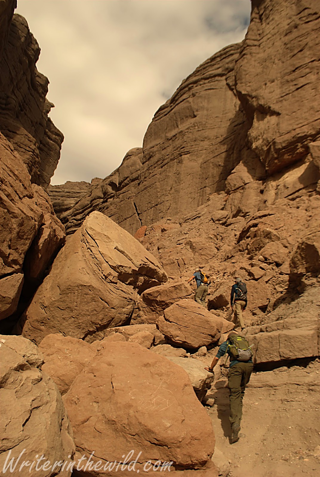
Despite the remote feel of the locale, the trailhead at Painted Canyon was packed full of vehicles, and in typical southwest style strewn with trash and broken bottles. We were immediately barricaded on both sides by towering rock walls as we started the hike. I tried my best to ignore all the graffiti littering the walls as we hiked in deeper. We were looking for a slot canyon known as "The Ladder Hike" that existed somewhere within the larger canyon, but lacking a very detailed map, we weren't sure of its exact location. Eventually we reached an arrow on the ground built from stones that pointed to a mass of boulders that evidently led to the slot canyon. If we hadn't seen the crude marker on the ground we would have passed unknowingly by, as the junction lacked any signage and took some scrambling to reach. 


The walls closed in around us. Once we made the slot canyon the entire hike changed. Some places light didn't reach. Others we had to slide through narrow rock passages. Ladders placed throughout the canyon created a really unique hiking experience as we dropped deeper inside. Although I had a great time, I felt quite uneasy at times in that little canyon. A rock slide from the top could easily have trapped us. We had anticipated a view of the Sultan Sea once we reached high ground, but rain clouds moving in from the distance convinced us to turn around and cut our hike short. Flash floods are dangerous, and in that little slot canyon there is virtually no way out.
Greg descending a ladder deeper into the canyon,

Mecca Hills

Saturday, November 28, 2015

#OptOutside: Needle Rock Beach

Needle Rock Beach
 I had four helpings of Thanksgiving dinner. The turkey was so moist and golden brown that I couldn't help myself. The sweet potato casserole was delicious. Friday I felt flat. I was ready to spend the day on the couch, watching old Christmas movies, and eating leftover pumpkin pie. Sarah got the family motivated, despite my reluctance to move, and soon we were packed in the car headed for the Verde River.

Hiking along the river
 I couldn't figure out why it was called Needle Rock beach. There were no big rocks shaped like needles, though I could see Weaver's Needle from the road, stabbing upward from the rugged Superstitions. It reminded me of my backpacking trip there last December, and suddenly I wished I was back, camping in the shadow of the needle under a billion stars. The kids don't know it, but I am buying both of them backpacks for Christmas. It's all part of my plan to spark in them a love for backpacking and the outdoors. My hope is that nature is creating impressions on their brains that will forever connect being outside to fun and happiness. 


Fishing at the beach didn't go well, so we followed a faint trail on the river's edge. Riparian areas like this are so unique because the ecology on the river is so different than the surrounding desert. One minute you're walking under the shade of cottonwoods, and the next your surrounded by cacti on a sunswept hillside. 


My family.
 We found a secluded little spot about a half mile from the beach that looked suitable for camping. There was already a firepit and an area for a tent. The best part was that it was located at a spot on the river that was really deep and heavily wooded. I think I'll take the kids there on their first backpacking trip.

Although I've never shopped on Black Friday before, I think I'll make #optoutside an annual family tradition. It's important to teach our kids what is really important in life. Nature has real value. Family has lasting meaning.

Until next time....